Yosemite National Park
( No user reviews )People who've been here (5)


People who'd like to go there (2)

Yosemite National Park is a United States National Park and a UNESCO World Heritage Site located in the Sierra Nevada mountains in east-central California. Yosemite is internationally recognized for its spectacular granite cliffs, waterfalls, clear streams, giant sequoia groves, and biological diversity. The 750,000-acre, 1,200 square-mile park contains thousands of lakes and ponds, 1600 miles of streams, 800 miles of hiking trails, and 350 miles of roads. It is currently the third most visited national park in the United States, with an annual visitation of nearly 3.9 million.
Understand
History
Efforts to protect Yosemite Valley began as far back as June 30, 1864 when President Abraham Lincoln signed a bill granting Yosemite Valley and the Mariposa Grove of Giant Sequoias to the State of California as an inalienable public trust. This was the first time in history that a federal government had set aside scenic lands simply to protect them and to allow for their enjoyment by all people. The area became a national park on October 1, 1890 following several years of struggle by John Muir against the devastation of the subalpine meadows surrounding Yosemite Valley.
Despite its national park status, California controlled the initial grant area until 1906. Prior to ceding control, the city of San Francisco became embroiled in a bitter political struggle over the Hetch Hetchy Valley, in which the city wanted to dam the Tuolumne River as a source of drinking water and hydroelectric power. In 1913, conservationists led by John Muir lost the battle when Congress passed the Raker Act, authorizing the construction of O'Shaughnessy Dam. To this day crusades to restore Hetch Hetchy are ongoing.
Yosemite has grown from a little visited, yet historically significant, park to one of the "crown jewels" of the US National Park System. With this stature comes difficulties; current visitation numbers roughly 3.5 million visitors per year, with a majority visiting 12 square miles within Yosemite Valley (about 1% of the total park land). The dual role of the park service -- protection of the resource and provide for the enjoyment of the visitor -- makes sure that Yosemite continues to be an important breeding ground for management ideas about US National Parks.
Climate
Weather can change rapidly during all seasons of the year, and will also vary greatly with elevation. When visiting it is wise to pack for any season with clothing that can be layered, ready to peel off or add on as conditions dictate. Always include some kind of rain gear; the park receives most of its precipitation in the months of January, February and March, but storms are common during the transitional spring and fall seasons, and spectacular thunderstorms may occur during summer.
For Yosemite Valley and Wawona (subtract 10-20°F (5-10°C) for Tuolumne Meadows), average weather is as follows:
Summer: Typically dry, with occasional thunderstorms; temperatures from 50°F (10°C) to the low 90°F (30°C) range.
Fall & Spring: Highly variable, with typical high temperatures ranging from 50-80°F (10-27°C) , with lows from 30-40°F (-1 to 4°C). Rain is less likely early in fall/late in spring and rain or snow is likely late in fall/early in spring.
Winter: Snowy, rainy, or (sometimes) even sunny days are possible, with highs ranging from 30-60°F (-1 to 16°C) and lows in the high 20°F (-4 to 0°C) range. Winter Storm Warnings indicate a significant storm is impending or occuring.
Landscape
Warm winter temperatures, a late-season tropical rainstorm, and a heavy snow pack combined to produce the greatest flooding on record in Yosemite Valley in January of 1997. A highly unusual winter rainstorm arrived in January, and the rainfall caused tremendous melting of the existing High Sierra snowpack. The resulting flood of rain and melted snow caused the Merced River to rise nearly ten feet above its normal level, producing over $178 million in damage in Yosemite Valley. As a result the Valley was closed for over three months, and vast changes were made to the area's management plan. Today numerous structures have been relocated, roads have been re-routed out of the flood plain, and nearly fifty percent of campsites have been removed. Signs indicating the floodwater height are posted throughout the Valley.
Yosemite is best known for the massive granite cliffs and domes found within the park. The landscape began forming about ten million years ago when the Sierra Nevada was uplifted and then tilted to form its relatively gentle western slopes and the more dramatic eastern slopes. The uplift increased the steepness of stream and river beds, resulting in formation of deep, narrow canyons. About one million years ago, snow and ice accumulated, forming glaciers at the higher alpine meadows that moved down the river valleys. Ice thickness in Yosemite Valley may have reached 4,000 feet during the early glacial episode. The downslope movement of the ice masses cut and sculpted the U-shaped valley that attracts so many visitors to its scenic vistas today.
The park is also home to the Yosemite Falls, at 739m (2425ft), the highest waterfalls in North America.
Flora and fauna
Yosemite has more than 300 species of vertebrate animals, and 85 of these are native mammals. Black bears are abundant in the park, and are often involved in conflicts with humans that result in property damage and, occasionally, injuries to humans. Visitor education and bear management efforts have reduced the bear-human incidents and property damage by 90% in the past few years. Ungulates include large numbers of mule deer. Bighorn sheep formerly populated the Sierra crest, but have been reduced to only a few remnant populations. There are 17 species of bats, 9 of which are either Federal or California Species of Special Concern. Over 150 species of birds regularly occur in the parks. Other species that are found within the park include bobcat, gray fox, mountain beaver, great gray owls, white-headed woodpeckers, spotted owls, golden-mantled ground squirrel, martens, Steller's jays, pika, yellow-bellied marmot, white-tailed hare, and coyotes.
The vegetation in the park is primarily coniferous forest. Most notable among the park's trees are isolated groves of giant sequoias, the largest trees in the world, which are found in three groves in Yosemite National Park.
Weather
Other natural dangers in the park come from the weather. Hypothermia can be a concern at higher elevations where temperatures can drop below freezing throughout the year. Dress in layers, and be prepared for storms and rapid changes in temperature. When storms are approaching avoid open areas such as the summits of the park's many granite domes; lightning strikes these areas regularly. If a storm does approach, get off of high, open ground. When hiking wear sturdy footwear and drink plenty of water - if you are thirsty that is an early sign of dehydration. Be aware that the sun can be intense at higher elevations and when reflected off of snow, so sunscreen is important.
Getting there
By car
Warning: There are no gas/petrol stations in the Yosemite Valley!
There are four major entrances into the park. All of these routes are relatively windy mountain roads and appropriate time should be budgeted for them. Be advised that the above can pose a safety risk, so when driving, stay alert and focused throughout the ride. Also, don't confuse the town of Oakdale to the west, with Oakhurst to the south.
State Route 120 from the west from Oakdale. This is the fastest route from locations west (Bay Area) and northwest (Sacramento). Route 120 is a bit steep, so RVs and trailers should consider Route 140 instead. In winter, snow makes the lower elevations of Route 140 more attractive.
State Route 140 west from Mariposa and Merced. This route mostly travels up the Merced River Canyon into Yosemite Valley and is the most scenic western entrance. RV and tour bus traffic used to congest this road a bit too much in summer. However, two new bridges to bypass a recent rock slide in the Merced River Canyon now limit vehicles to 45 feet. Many visitors are still unaware of the new bridges over the Merced River and assume State Route 140 is still closed. Highway 140 is now pleasantly less congested and the bridges afford an excellent view of the massive rock slide.
State Route 41 north from Fresno and Los Angeles/Southern California. Be sure to fill your gas tank in Oakhurst (several stations along highway), or pay dearly as you get closer to the park.
State Route 120 from the east (Tioga Pass Road) from Lee Vining and points east. This road is only open from June through October, although heavy snow may force closure in late September and push opening back to late July.
A secondary entrance exists to Hetch Hetchy Reservoir exclusively (no Yosemite Valley access) off of State Route 120 from the west. It requires taking a side road near the main Route 120 west entrance of Yosemite. Please note that Hetch Hetchy has restricted hours for access due to security for the Reservoir. Please check with Yosemite National Park information before heading out to Hetch Hetchy.
During the snow season, usually November through March, snow chains may be required. Chain requirements are strictly enforced in Yosemite with potential fines being as much as $5,000, so chains should be carried during those months.
Note: During summer months traffic becomes heavily congested in Yosemite Valley, and parking can be nearly impossible to find. Summer visitors to Yosemite Valley are therefore highly encouraged to use the YARTS shuttle system (see below) to get into the park.
By plane
There are no landing strips within the park. Airports in surrounding communities include:
Fresno-Yosemite International (FAT), Fresno. Located approximately 1.5 hours (by car) south of the park's entrance on Highway 41. Non-stop flights to Fresno are available from Dallas, Denver, Guadalajara, Los Angeles, Las Vegas, Phoenix, Portland, Salt Lake City, and San Francisco .
Merced Airport (MCE), Merced. Located approximately two hours (by car) from Yosemite Valley on Highway 140.
Modesto City-County Airport (MOD), Modesto. Located approximately 1.5 hours (by car) from the park's east entrance on Highway 120.
Bay Area airports including San Francisco International (SFO), Oakland International (OAK) and San Jose International (SJC) are larger and offer more flights. Driving distance from the Bay Area is approximately four hours. Sacramento International airport (SMF) in Sacramento is is another large airport option that is also about a four hour drive from the park. Visitors arriving from the east may choose Reno/Tahoe International (RNO) in Reno, which is approximately 3.5 hours (by car) from the Tioga Pass Entrance (summer only).
Small private aircraft land at Mariposa-Yosemite Airport (KMPI) about 5 mi/8 km northwest of the town of Mariposa on Highway 49. There is no control tower, and car rentals in the area are very limited. The YARTS shuttle (see below) is another possibility. Park entrance is an additional 27 mi/44 km via State Route 140.
By train
Amtrak offers service to Yosemite by means of a motorcoach bus that meets its San Joaquins trains in Merced. The San Joaquins provide several departures each day along its route from Bakersfield in the south, Sacramento in the north, and the San Francisco Bay Area in the west. With ample motorcoach connections to and from the trains, this train service serves most of the state, allowing quick and easy access to Merced from most places within the state. However, by driving from San Francisco to Yosemite, it will take 4 1/2 to 5 hours. By train, it will take closer to six hours.
By bus
Many tour bus companies run tours from the Bay Area. Some will just take you to Yosemite Valley; others provide full tours to see the Giant Sequoias and/or Glacier Point.
By shuttle
The Yosemite Area Regional Transportation System (YARTS) offers reasonably-priced transportation into Yosemite Valley from towns east and west of the park including Merced, Mariposa, El Portal, Lee Vining and Mammoth Lakes. Tickets can be purchased ahead of time or from the shuttle driver, and round-trip fares are between $7 (from El Portal) to $20 (from Merced and Mammoth Lakes) into Yosemite Valley. When combined with the free shuttle service that operates within Yosemite Valley YARTS can eliminate many hassles for summer visitors.
Traveling around
By car
In general a car is a great way to tour the park, although during the summer Yosemite Valley can be so crowded that a shuttle bus is a vastly better option. Be aware that the Tioga Pass Road and the road to Glacier Point are seasonal and close as soon as the first major snow falls. Other park roads may close during storms, but in general are always open. Note that the speed limit in all areas of the park is fairly slow, and is strictly enforced by rangers with radar guns; the speed limits are for your own safety on the twisting mountain roads, as well as for the safety of pedestrians and the many animals that use the area.
The loop road through Yosemite Valley is now one-way. For many years this was a two-lane road, but motorists travelling slowly to admire the scenery often created a long backup of annoyed drivers, so the Park Service converted most of the roads in the valley into one-way roads to allow passing. As a result, when driving in the valley be aware that a wrong turn can send you on a one-way five-mile detour.
By shuttle
To limit traffic congestion the park service runs several free shuttle buses throughout the park (note that these are not the YARTS system):
Yosemite Valley. Shuttles operate from 7AM until 10PM in the eastern portion of Yosemite Valley year-round, stopping at or near all accommodations, shopping areas, and major sights.
Wawona-Mariposa Grove. Between spring and fall a free shuttle operates between Wawona and the Mariposa Sequoia Grove. Parking is often full at the grove, so the shuttle then becomes the only option for visiting.
Badger Pass Bus. During the ski season a free bus travels twice daily between Yosemite Valley and the ski area.
Tuolumne Meadows Shuttle Bus. During the summer season this bus provides access to points in and around Tuolumne Meadows.
Tuolumne Meadows Hikers' Bus (fee charged). This bus travels in summer between Yosemite Valley and Tuolumne Meadows, dropping hikers off along the way. To guarantee seating tickets should be purchased one day in advance by calling (209) 372-1240.
Glacier Point Hikers' Bus (fee charged). This bus provides service between Yosemite Valley and Glacier Point, making stops along the way. To guarantee seating tickets should be purchased one day in advance by calling (209) 372-1240.
On foot
Although the road network covers the most popular sights in Yosemite, the vast majority of the park's area can only be accessed using the park's network of trails. Trails including the John Muir Trail and the Pacific Crest Trail lead to areas outside of the park's north and south borders.
See
The park is extremely large with more than can be seen in just a one or two day visit. The peak seasons for Yosemite are generally Spring, when the waterfalls in the Valley are strongest, and Summer, when the Tioga Pass and Glacier Point roads are open, giving visitors access to the higher meadows and to views of the Valley from above.
Yosemite Valley
Yosemite Valley is world famous for its impressive waterfalls, meadows, cliffs, and unusual rock formations. Yosemite Valley is accessible by car all year, but during the summer months traffic can feel like a city rush hour rather than a national park, making shuttle bus usage highly recommended.
Perhaps the most famous sight in the valley is the granite monolith of Half Dome, a mountain whose sheer face and rounded top looks like a giant stone dome that has been split in half. The imposing vertical face of El Capitan is legendary among climbers, and numerous lesser-known features line the valley.
Equally famous for its waterfalls, Yosemite Falls is one of the highest waterfalls in the world at 2425 feet (782 m), and is most impressive during the spring months. Bridalveil Fall is another easily accessible waterfall, while Nevada Fall and Vernal Fall can be reached by those willing to do some hiking.
Another popular viewpoint is the Tunnel View. The spot gives visitors a view of the Yosemite Valley with El Capitan on the left, Bridalveil Fall on the right and Half Dome in the center. The view point is located on the 41 at the western end of the Wawona tunnel. There is a small parking lot near the lookout.
Wawona
Wawona is the home to the historic Wawona Hotel, dating from the late nineteenth century. The Pioneer Yosemite History Center, a collection of historic buildings, is located just over the covered bridge from the hotel. Wawona is accessible by car year-round.
The Mariposa Grove is south of Wawona near the entrance station. The Mariposa Grove is the largest stand of giant sequoias (also known as Sierra redwoods or big trees) in Yosemite. The road to the Mariposa Grove is not plowed in winter and is often closed from sometime in November through March.
Glacier Point and Badger Pass
Glacier Point, an overlook with a commanding view of Yosemite Valley, Half Dome, and much of the Sierra Nevada mountain range, is located 30 miles (one hour) from Yosemite Valley. The road ends at Glacier Point and a quarter mile long paved walkway leads to one of the most spectacular viewpoints in the park. The road is closed from sometime in November through early May or late June. From mid-December through early April the road is plowed only as far as the Badger Pass ski area and Glacier Point can be reached via skis or snowshoes only. Both downhill and cross-country skiing are available at Badger Pass from mid-December through early April.
Washburn Point, another overlook on the same road, appears about half a mile before Glacier Point. This overlook gives a view of the southern side of the Yosemite Valley.
Tuolumne Meadows
The Tioga Road (Highway 120 East), is generally open to vehicles from late May or early June through sometime in November. It offers a 39 mile scenic drive between Crane Flat and Tuolumne Meadows through forests and past meadows, lakes, and granite domes. Many turnouts offer broad and beautiful vistas.
Tuolumne Meadows is a large, open sub-alpine meadow graced by the winding Tuolumne River and surrounded by majestic peaks and domes. From sometime in November through late May or early June, this area is only accessible by cross-country skis or snowshoes. One of the easiest ways to explore the Meadows is to take the dirt road past the Dog Lake trailhead (along Tioga Rd.) for a quarter mile. There you'll find a metal gate and a fire road behind it. The road you're driving on curves sharply to the right here. Park and follow the road past the gate. The first mile of this road provides you with up-close views of the Meadow's beauty, particularly toward the left (south).
Crane Flat
Crane Flat is a pleasant forest and meadow area located 16 miles (30 minutes) from Yosemite Valley. Nearby are the Tuolumne and Merced Groves of Giant Sequoias, which are only accessible by foot. Crane Flat is accessible by car all year. Bears can be spotted in the meadows in this area regularly, so keep your eyes open and don't block traffic if you see one!
Hetch Hetchy Valley
Hetch Hetchy, a lesser known twin to Yosemite Valley (perhaps because its river has been dammed), is home to spectacular scenery and is the starting point for many less-used wilderness trails. Although the road to Hetch Hetchy is open year-round, on a day to day basis it has restricted hours due to security for the reservoir. It may close periodically due to snow in winter and spring. During the spring and early summer, impressive water falls flow into the reservoir, making hiking in Hetch Hetchy even more spectacular.
Things to do
Hiking
Physically-fit travelers will enjoy hiking the Park's many trails and footpaths. Check with rangers for trail conditions; snow and hazards from falling rock close many trails in winter, and the cables on the Half Dome trail are only up from late May through early October (ascending Half Dome when the cables are not erected is possible but is dangerous and strongly discouraged). No permits are required park-wide for day hikes.
Yosemite Valley
Many of the meadows have short trails, some of which are handicap accessible. For those staying in the valley, walking to get around is easy, scenic, and avoids the stresses of car travel in the valley.
Lower Yosemite Fall. (0.5 mi / 0.8 km round-trip). This easy paved trail starts at the Lower Yosemite Fall shuttle bus stop and provides a good view of the falls with a close-up view of the lower fall. (Note: this waterfall is often dry from August through October.) Since the trailhead falls on the Northside Dr, it's better to see the falls on your way out of the Yosemite Valley.
Bridalveil Fall. (0.5 mi / 0.8 km round-trip). Another easy paved trail starting from the Bridalveil Fall parking area and leading to the bottom of Bridalveil Fall. The trailhead to this fall falls on the Southside Dr. So, it's best to visit it on your way to the Valley.
Mirror Lake/Meadow (2 mi / 3.2 km to Mirror Lake, 5 mi / 8 km around the lake). Starting from the Mirror Lake trailhead shuttle bus stop, the trail leads along an old road to what is a large pond in spring and a meadow the rest of the year. The largely dry lake is mostly a meadow that is at the bottom of Half Dome and provides excellent views. Those who are interested can also hike around the lakebed.
Valley Floor Loop (6.5 mi / 10.5 km round-trip with cutoff, 13 mi / 21 km without). The loop trail around Yosemite Valley can be hiked in pieces or in full. Following the road in places, the trail can be shortened by crossing the bridge just east of El Capitan Meadow.
Vernal Fall (Mist Trail) (3 mi / 4.8 km round-trip). This strenuous hike starts from the Happy Isles shuttle bus stop and leads to the top of Vernal Fall. From the Vernal Fall footbridge onwards the trail offers excellent views of the 317 foot (97 m) high Vernal Fall. Past the footbridge the trail becomes steep and may be slippery and the spray from the falls will get you quite wet as it traverses 600 granite steps to the top of the waterfall.
Nevada Fall (Mist Trail) (7 mi / 11.2 km round-trip). Nevada Fall is located further along the Mist Trail, past Vernal Fall. This strenuous hike leads to the top of Vernal Fall, up more granite steps, and to the top of Nevada Fall.
Panorama Trail (8.5 mi / 13.7 km one-way). Starting from Glacier Point the Panorama Trail offers panoramic views of the valley and close-up views of three waterfalls (including lesser known Illilouette Fall) before continuing down the Mist Trail and ending at Happy Isles. From late May or early June through October, a fee-based hikers bus will take you up to Glacier Point.
Four Mile Trail to Glacier Point (9.6 mi / 15.5 km round-trip). Starting from the Four Mile Trailhead just west of Swinging Bridge picnic area, this strenuous trail follows switchbacks up to Glacier Point. The trail offers spectacular views up and down Yosemite Valley. Visitors interested in a long day hike can return to Yosemite Valley via the Panorama Trail.
Upper Yosemite Fall (7.2 mi / 11.6 km round-trip). Starting near the Camp 4 shuttle bus stop, this extremely strenuous trail switchbacks to the top of the 2,425 foot (739 meter) high Yosemite Falls. The trail provides great views of Half Dome and eastern Yosemite Valley. Those without the time (or energy) to make it to the top can hike about one mile to the railed-in Columbia Rock, which itself has great views. In summer, the trail is hot and dusty, so bring lots of water.
Half Dome (17 mi / 27.4 km round-trip). One of the most spectacular trails in the world, the Half Dome trail starts at the Happy Isles shuttle bus stop, travels past Vernal Falls, and Nevada Falls, and then continues rising through a pine forest before opening up near the summit of Half Dome. The final mile is a grueling trek up granite steps, followed by wire cables that lead up the steep ascent to the top of Half Dome. Hikers should bring leather work gloves to protect their hands from the cables; some gloves are often available in a pile at the bottom of the cables. While it is possible to ascend Half Dome while the cables are down (between approximately October 15 and May 15), hikers do so at their own risk. Views and scenery are unforgettable, but hikers should be aware that the final climb up the back side of Half Dome via the cables can be exhausting and, for those with even a mild fear of heights, frightening. Starting in 2010 permits will be required for day hikes of Half Dome on weekends and holidays; rangers will be stationed on the trail to turn away hikers without permits.
Glacier Point
McGurk Meadow, Bridalveil Creek, & Dewey Point (7 mi / 11.2 km round-trip). Starting at the McGurk Meadow trailhead parking area (west of the Bridalveil Creek Campground turnoff) this trail leads downhill to an old cabin built by John McGurk and a large meadow. Continue east (right) at the trail junction to get to Bridalveil Creek (4 mi / 6.4 km) or continue west to a Dewey Point (7 mi / 11.2 km), which has a spectacular view of western Yosemite Valley.
Ostrander Lake (12.7 mi / 20.3 km round-trip). Beginning at the Ostrander Lake trailhead parking area (1.3 mi / 2.1 km east of Bridalveil Creek Campground), the first half of this hike gains little elevation; the second half gains about 1,500 ft (450 m). As the trail rises it offers views of the Clark Range before eventually arriving at Ostrander Lake.
Mono Meadow (3 mi / 4.8 km round-trip). Starting from the Mono Meadow trailhead parking area (2.5 mi / 4 km east of Bridalveil Creek Campground) the trail descends steeply to Mono Meadow, an area which is wet, particularly early to mid summer (be sure to stay on the trail, even if it is muddy). Shortly after leaving Mono Meadow, the trail passes through an unmarked clearing with views of the Clark Range, Mount Starr King, and Half Dome.
Taft Point (2.2 mi / 3.5 km round-trip). The trailhead is located at the Sentinel Dome/Taft Point trailhead parking area (6 mi / 9.6 km east of Bridalveil Creek Campground) and the relatively easy trail leads to the edge of Yosemite Valley. As the trail approaches Taft Point watch for fissures, which are deep cracks extending hundreds of feet downards. The railed-in Taft Point offers a breathtaking view of Yosemite Valley, 2,000 feet (600 m) below.
Sentinel Dome (2.2 mi / 3.5 km round-trip). Starting at the Sentinel Dome/Taft Point trailhead parking area, (6 mi / 9.6 km east of Bridalveil Creek Campground), the Sentinel Dome trail is an easy hike that leads to the base of Sentinel Dome, where you can scramble up the granite slope of the dome (it is not especially steep on its northeast side). From the top, you have a spectacular 360° view of Yosemite Valley (including Yosemite, Vernal, and Nevada Falls) and parts of the high country. A loop including Taft Point is a nice addition, but the climb from Taft Point to the top of the dome goes up several hundred feet.
Tuolumne Meadows
Soda Springs & Parson's Lodge (1.5 mi / 2.4 km round-trip). Beginning at the Lembert Dome parking area, the trail follows the gravel road northwest past a locked gate. The Soda Springs are protected within a log enclosure. Carbonated water bubbles up through the ground, but drinking the water is not recommended due to possible surface contamination. Further along the trail is the historic Parson's Memorial Lodge, which offers exhibits.
Dog Lake (2.8 mi / 4.5 km round-trip). Starting at the Dog Lake/John Muir Trail parking area the trail goes up steeply and crosses the Tioga Road, then continues up for 0.75 mi (1.2 km) to a signed junction. Continue straight to Dog Lake. Enjoy fishing and picnicking from this high country lake.
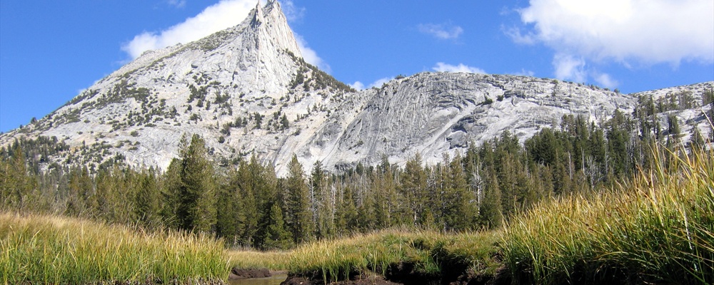
Lembert Dome (2.8 mi / 4.5 km round-trip). A strenuous hike beginning at the Dog Lake/John Muir Trail parking area, this trail goes up steeply for 0.75 mi (1.2 km) to a signed junction. The trail to the left goes to the top of Lembert Dome. Expect a spectacular panoramic view of Tuolumne Meadows, Cathedral Peak, and Unicorn Peak. The top of the dome can be windy and quite a bit cooler than down below.
Dog Lake and Lembert Dome (5.0 mi loop). These two hikes can be combined in a loop that delivers some of the best scenery from any five-mile hike in the park. Do the lake first, before you get tired from the dome climb.
Glen Aulin (11 mi / 17.7 km round-trip). A moderately difficult trail starting from the road near Tuolumne Meadows Stables, the trail follows the gravel road as it loops behind Soda Springs and drops to Glen Aulin. The route is noted for scenic cascades, particularly Tuolumne Falls, located 4 miles from the trailhead.
Elizabeth Lake (4.8 mi / 7.7 km round-trip). Starting near the Tuolumne Meadows Group Campground this moderately difficult hike climbs steadily to the glacier-carved lake at the base of Unicorn Peak. To reach the trailhead, drive past the group campsites to where the road ends. There are restrooms there.
Cathedral Lakes (7 mi / 11.3 km round-trip). From the Cathedral Lakes Trailhead the trail climbs steadily (1,000 ft / 305 m) to Upper Cathedral Lake. Near the top, it passes a spur trail to Lower Cathedral Lake.
John Muir Trail through Lyell Canyon (8 mi / 12.9 km one-way). From the Dog Lake/John Muir Trail parking area this relatively flat trail (only 200 ft / 61 m elevation gain over 8 mi / 12.9 km) wanders through Lyell Canyon, mostly alongside the Lyell Fork of the Tuolumne River.
Mono Pass (8 mi / 12.9 km). A moderately difficult trail that starts at the Mono Pass Trailhead (6 mi / 4.4 km east of Tuolumne Meadows) and climbs gently at first (1,000 ft / 304 m elevation gain) to a junction with Spillway Lake. The left fork then steeply climbs to Mono Pass, at 10,500 ft / 3,200 m. From the pass, Upper Sardine Lake is another 0.75 / 1.2 km down the pass to the east.
Gaylor Lakes (2 mi / 3.2 km) A strenuous trail starting from the Gaylor Lakes Trailhead (at the Tioga Pass Entrance Station) and climbing steeply in the first 0.5 mi / 0.8 km (1,000 ft / 304 m elevation gain) to a ridge with views to both sides. At the ridge, the trail drops 200 ft / 61 m to a lake and meadows, which can be explored with side trails.
Vogelsang High Sierra Camp, Lake, and Pass (15.8 mi / 25.5 km). Starting from the Dog Lake/John Muir Trail parking area, the trail's first 2 mi / 3.2 km, along the John Muir Trail, are relatively level. The Rafferty Creek Trail then splits off and begins a 1,200 ft / 366 m ascent to Tuolumne Pass, followed by a 160 ft / 49 m climb to the High Sierra Camp. You can continue to Vogelsang Lake (0.5 mi / 0.8 km further) and spectacular Vogelsang Pass (1.5 mi / 2.4 km further).
Wawona & Mariposa Grove
Wawona Meadow Loop (3.5 mi / 5.6 km rount-trip). Starting at the golf course across the street from the hotel, the trail is a pleasant stroll on a fire road around the Wawona Meadow.
Swinging Bridge Loop (5 mi / 8 km round-trip). A moderate hike leading from the Wawona Store to the swinging bridge, the trail follows the paved Forest Drive 2 mi (3.2 km) upstream from the history center and then continues on the dirt road for a short distance to the swinging bridge (which really does swing). Cross the bridge and bear left onto the dirt road, which soon becomes paved Chilnualna Falls Road. When you reach the Wawona Stable, walk into it towards the Covered Bridge, where you started this hike.
Chilnualna Fall (8.2 mi / 13.1 km round-trip). From the Chilnualna Fall trailhead parking area, this strenuous hike leads past the cascades of Chilnualna Fall and all the way to the top of the fall. For the hearty day-hiker, the trip can be extended 18 miles (round-trip) to reach Crescent Lake.
Alder Creek (12 mi / 18.7 km round-trip). Beginning at the Alder Creek trailhead parking area, this strenuous trail climbs through an open pine forest with abundant manzanita on the drier slopes.
Wawona to Mariposa Grove (6 mi / 9.6 km one-way). Starting near the Moore Cottage at the Wawona Hotel this generally viewless hike leads to the Mariposa Grove of Giant Sequoias. From late April through September, you can take the free shuttle bus from the grove back to Wawona.
Mariposa Grove of Giant Sequoias (6 mi / 9.6 km round-trip). There are numerous trails leading through this grove of giant trees, all starting from the Mariposa Grove parking area. To reach the Grizzly Giant and California Tunnel Tree, follow the trail that begins at the far end of the parking area. To reach Wawona Point, continue on the trail past the Grizzly Giant into the upper grove. The old road ascends to Wawona Point from near the Galen Clark Tree.
Hetch Hetchy
Wapama Falls (5 mi / 8 km round-trip). Starting from the O'Shaugnessy Dam, this easy trail leads to the bottom Wapama Falls (and Tueeulala Falls in spring).
Rancheria Falls (13.4 mi / 21.4 km round-trip). A moderately difficult hike that starts from the O'Shaugnessy Dam and provides numerous views of the Hetch Hetch Valley.
Poopenaut Valley (3 mi / 4.8 km round-trip). This oddly named trail begins four miles from the Hetch Hetchy Entrance Station and provides quick access to the Tuolumne River, descending 1,229 feet (735 m) to the river below O'Shaugnessy Dam.
Smith Peak (12.5 mi / 20 km rount-trip). A strenuous trail from the Hetch Hetchy Ranger Station to Smith Peak. Forests and meadows eventually give way to great views of the Hetch Hetchy area.
Rock climbing
The Valley also offers some of the most challenging and spectacular rock climbing in North America, with vertical faces 3,000 and more feet tall. At the current time, wilderness permits are not required for nights spent on a wall, but it is illegal to camp at the base of any wall in Yosemite Valley. Additional regulations:
Fight litter! Don't toss anything off a wall, even if you intend to pick it up later. Don't leave food or water at the top or on ledges "for future parties". Set a good example by picking up any litter you see, including tape wads and cigarette butts.
Don't leave fixed ropes as permanent fixtures on approaches and descents. These are considered abandoned property and will be removed.
Minimize erosion on your approach and descent. If an obvious main trail has been created, use it. Go slow on the way down to avoid pushing soil down the hill. Avoid walking on vegetation whenever possible.
If you need to build a fire for survival during an unplanned bivouac on the summit, use an existing fire ring. Building a new fire ring or windbreak is prohibited. Make sure your fire is completely out before you leave.
Clean extra, rotting slings off anchors when you descend. Bring earth-toned slings to leave on anchors.
Check the Camp 4 Kiosk or the Mountain Shop for the current Peregrine Falcon closures.
On first ascents: Please think about the impacts that will be caused by your new climb- Is the approach susceptible to erosion? Is there a lot of vegetation on the rock? "Gardening", e.g. killing plants, is illegal in Yosemite. Can the climb be done with a minimum of bolts? Motorized drills are prohibited.
Commercial guided climbing trips are also available:
Horseback riding
There are still commercial horseback-riding concessions in the Yosemite Valley, Wawona and Tuolumne Meadows areas.
Golf
Skiing
Badger Pass is the oldest ski area in California, and offers both downhill and cross-country trails. For cross-country skiers the park offers over 350 miles of trails, with 90 miles of marked trails and 25 miles of groomed trails originating at Badger Pass. Downhill skiing options include ten runs at Badger Pass, with lifts operating daily from 9AM-4PM during the ski season. Note that the majority of these runs are for beginners and moderate skiers, so thrill seekers may wish to ski elsewhere. Lift tickets cost $5 for a single run or $35 for a full-day ticket. Both downhill and cross-country lessons are available.
Due NPS regulations in place to ensure the area remains as natural as possible, the Badger area has no artificially-lighted skiing and cannot make it's own snow.
Badger Pass is open around Dec 15th and closes around April 1st.
Badger Pass opened for the 2009-2010 season on December 18th.
Eat
Groceries can be purchased in Yosemite Village, Crane Flat, Curry Village, Wawona, and Tuolumne Meadows.
Yosemite Valley
Ahwahnee Dining Room , +1-209-372-1489, An upscale restaurant in Yosemite Valley serving breakfast, lunch and dinner. Famous also for its Sunday Grand Buffet. Be aware that there is a
The Mountain Room , Open daily year-round, this dining room is located in Yosemite Lodge and offers dinner with a view of Yosemite Falls. A significant portion of its menu includes organic and sustainable food. Food and service that's just as good as the Ahwahnee with menu prices that are 20% less and without the dress code.
Yosemite Lodge Food Court, Serving cafeteria-style meals in Yosemite Lodge. Offers breakfast, lunch and dinner year-round.
Degnan's Deli, Open year-round and offering standard deli fare, located in Yosemite Village.
Degnan's Loft, Open to the public from April to October from 12pm to 9pm, offering pizza, salads and soups in Yosemite Village. Open only to park employees and residents November through March from 5pm to midnight (last call at 11:30pm). Pizzas and salads are available only from 5pm to 9pm. They also add pool tables and video games during the winter. They are removed during tourist season to maximize seating.
Degnan's Cafe, Next to Degnan's Loft, serving
Village Grill, Fast food in Yosemite Village. Open from Spring through Fall. Closes for the day if weather is poor.
Curry Village Pavilion Buffet, Located in Curry Village, this buffet offers both a breakfast and a dinner buffet.
Curry Village Taco Stand, Burritos, tacos, nachos, ice cream and beverages. Open Seasonally from April to October.
Curry Village Pizza Deck, Pizza and salads. Open March through December. The food offered is nearly identical in quality and price as the Loft, but if crowds aren't your cup of tea then it might be best to avoid this establishment.
Curry Village Ice Cream & Coffee Corner, Open March through December.
Happy Isles Snack Stand, Offering drinks and snacks during the summer. Located near the Happy Isles nature center. Handy when you come off the trail, and want something.
Wawona
Wawona Dining Room, Fine dining, serving breakfast, lunch and dinner daily, with a brunch served on Sundays.
Wawona Lawn Barbecue, On Saturday evenings in summer the lawn outside of the Wawona Lodge hosts a barbecue featuring steak, chicken, hamburgers and corn-on-the-cob.
Wawona Golf Shop Snack Stand, Snacks, beer, and other beverages on the golf course. Open daily from spring through fall.
Tuolumne
Tuolumne Meadows Lodge, +1-209-372-8413, Family-style meals served in a tent setting. Reservations are required for dinner.
Tuolumne Meadows Grill, To-go food for breakfast, lunch and dinner. Open daily in summer.
White Wolf Lodge, +1-209-372-8416, Located near the Tioga Pass Road (about half way between Tuolumne Meadows and Crane Flat) and serving breakfast and dinner. Reservations are advised for dinner.
Glacier Point
Drink
The Ahwahnee Lounge, Ahwahnee Hotel, An upscale lounge in Yosemite Valley, offering cocktails, wine, beer, and bar food (sandwiches, appetizers, salads) with seating available both inside and on the terrace. Opens at 11:00 AM daily, with live piano music most Friday and Saturday evenings.
Mountain Room Lounge , Yosemite Lodge, Located in Yosemite Lodge, this lounge offers cocktails and bar food. Televisions are also placed around the room for those who have escaped to Yosemite but can't bear to miss the game.
Pavilion Bar, Curry Village, Located in Curry Village, this bar serves cocktails, beer, wine and fast food with both inside and deck seating. Extremely popular among employees. Seasonal.
Wawona Cocktail Service, Wawona Hotel, Within the Wawona hotel a cocktail service is available in both the lounge and on the veranda.
Sleep
Demand for lodging in Yosemite Valley in both the hotels and the campgrounds is extremely heavy, so you need to book well ahead of time during the late Spring, Summer and early Fall, although there are often vacancies during the Winter, late Fall and early Spring. Cancellations occur on a random basis, so it is also advised to call back frequently for a desired reservation date.
Lodging
The Ahwahnee , (801) 559-4884, 99 luxury hotel rooms and 24 cottages in Yosemite Valley. The lodge is a national historic landmark and the most upscale lodging in the park, with rooms facing Half Dome, Glacier Point or the West Valley. There is a small heated outdoor pool.
Yosemite Lodge at the Falls , (801) 559-4884, Located near the base of Yosemite Falls, this lodge offers 245 rooms, but be aware that no rooms have air conditioning. Internet access (in-lobby wireless and kiosks) is now also available. There is an outdoor pool located on the premises, as well as the main activities desk for the park.
Wawona , (801) 559-4884, This historic lodge overlooks Wawona Meadow in the south part of the park along Route 41. Of the 104 rooms only 50 have a private bath. The lodge is rustic, with no telephones or televisions. In the winter months the lodge is only open on select weekends and holiday periods.
Curry Village , (801) 559-4884, Located in Yosemite Valley, Curry Village offers a wide range of lodging options ranging from
Housekeeping Camp , (801) 559-4884, Despite its name, Housekeeping Camp (located near Curry Village) offers 266 sturdy tents for visitor lodging. The
White Wolf , (801) 559-4884, Located along the Tioga Pass Road, White Wolf is open from July through September and offers 24 tent cabins and 4 cabins with private bath. The tent cabins are wood frame on a raised wooden platform and include beds, linen, and a wood stove.
Tuolumne Meadows , (801) 559-4884, Open from mid-July through September, Tuolumne offers 69 tent cabins in Tuolumne Meadows. These tent cabins have wooden frames, a concrete floor, and canvas walls. Bunks beds, linens, candles, and a wood stove are provided, while bathrooms and showers are located in a central facility.
High Sierra Camps , (801) 559-4884, The five High Sierra Camps are villages of tent cabins located in Yosemite's backcountry, with most of the tent cabins holding four people (be prepared for mixed gender sleeping arrangements). Due to their remote locations the High Sierra Camps are normally visited as part of a horseback package tour or a hiking trek, with each camped spaced a day's hike apart. All of the High Sierra Camps include gourmet breakfast and dinner, and eat-in only reservations may be possible for those not needing accommodation. The High Sierra Camp cooking is widely regarded by locals as some of the best food in Yosemite. Some lodges may have hot showers, and all require that you bring your own linens. Demand for the High Sierra Camps is so high that reservations are handled by a lottery held from October 15 to November 30 (call for an application) with final assignments decided by March 31. Be aware that it is sometimes possible to get a High Sierra Camps reservation later if someone cancels.
The Redwoods in Yosemite , +1-209-375-6666, +1-209-375-6666, There are over 130 private cabins in the Wawona area that may be rented from their owners. Ranging from log cabins to spacious vacation homes, all homes are completely furnished, including linens, cookware, dishes, and a barbecue grill.
Yosemite Vacation Homes , Yosemite Vacation Homes offers 11 unique homes and cabins for nightly rent in the Foresta area. Foresta is inside the gates of Yosemite National Park and only 7 miles from Yosemite Valley.
Camping
Camping is by far the cheapest way of staying within the park, but campgrounds fill quickly during summer months and may require making reservations months in advance. Reservations can be made through the from 7AM-7PM PST, or by calling 1-877-444-6777 or +1 518-885-3639 from outside the United States. Written reservation requests can be made by including desired location, type of equipment you will be camping in (i.e.,tent, RV,etc.), as well as method of payment. Send written requests to NPRS, P.O. Box 1600, Cumberland, MD 21502.
All campgrounds offer bear-safe food storage containers, tap water (except where noted), and flush toilets. Pay showers and laundry are located in Curry Village in Yosemite Valley. During summer, showers are also available afternoons at Tuolumne Meadows Lodge.
For backpackers, North Pines in Yosemite Valley and the Tuolumne Meadows campground both have "backpacker camps". These are walk-in sites offered for people with valid wilderness permits to stay the night before and the night after their backcountry trips. For more information contact the Yosemite Valley Wilderness Center or any park campground office.
Yosemite Valley
In the main section of Yosemite Village, you cannot go further east than the parking area, as Northside Drive becomes one-way at this point. Turn at Sentinel Road (0.1 mi/0.2 km) to the west of the parking lots, cross the bridge, then turn left and continue on Southside Dr. along the Merced River to the Pines Campgrounds (1.6 mi/2.5 km). If staying in the North Pines, re-cross the river at Clarks Bridge. Getting in via the Ahwahnee Hotel is not possible either, except on foot or bicycle. Most GPS units do not handle routing to the Pines Campgrounds correctly, and direct you to go the wrong way on Northside Dr. (Tip: make the south end of Sentinel Bridge an intermediate stop.)
Upper Pines, Located in Yosemite Valley and open year-round, this campground requires reservations and offers 238 sites for both tents and RVs.
Lower Pines, Located in Yosemite Valley, this campground is open from March through October, requires reservations, and offers 60 sites for both tents and RVs. Three larger sites are also available for groups of up to 12 people for $30 per night.
North Pines, Located in Yosemite Valley, this campground is open from April through September, requires reservations, and offers 81 sites for both tents and RVs.
Camp 4, This walk-in campground is located in Yosemite Valley, open year-round, and offers 35 sites on a first-come, first-served basis. All sites are tent only. Note that with six people assigned to every site this isn't the quietest of campgrounds, so light sleepers may want to bring earplugs. Campground is popular among the local rock climbing community.
Wawona
Glacier Pass
Crane Flat
Hodgdon Meadow, This campground is located north of Crane Flat near the park entrance and is open year-round. Reservations are required from April through September, and offers 105 sites for both tents and RVs. Four group sites are available for 15-25 people.
Crane Flat, Crane Flat is open from June through September, requires reservations, and offers 166 sites for both tents and RVs.
Tioga Pass Road
Tamarack Flat, Open from June through September, this campground is located off of the Tioga Pass Road near Crane Flat and offers 52 tent sites on a first-come, first-served basis. Creek water only.
White Wolf, White Wolf is open only from July through early September and is located along the Tioga Pass Road. The 74 sites are first-come, first-served for tents and small RVs only.
Yosemite Creek, Open from July through early September, this campground is located off of the Tioga Pass Road and offers 75 sites on a first-come, first-served basis for tents only. Creek water only.
Porcupine Flat, Porcupine Flat is located off of the Tioga Pass Road and offers 52 tent and RV sites from July through early September on a first-come, first-served basis. Creek water only
Tuolumne Meadows, The Tuolumne Meadows campground is open from July through September and offers 50% of its sites as reservation only, while 50% are first-come, first-served. 304 sites are available for both tents and RVs. Be prepared for chilly nighttime temperatures.
Backcountry
Backcountry permits are free and are required year-round for all overnight trips into Yosemite's wilderness. Wilderness areas operate under a quota system that limits the number of people who may begin overnight hikes from each trailhead, each day. While permits may be reserved, at least 40% of each trailhead quota is available on a first-come first-served basis the day of, or one day prior to, the beginning of your trip.
Permits can be obtained in person from the wilderness stations in Yosemite Village, Big Oak Flat, Tuolumne Meadows, Badger Pass, Hetch Hetchy and Wawona. In addition, permits can be reserved in advance from mid-May through September for a $5 fee. There are three ways to reserve a wilderness permit:
By phone. Reservations for summer trips are accepted from 2 days to up to 24 weeks in advance by calling (209) 372-0740. You must know your entry and exit trailheads prior to calling.
By mail. Reservation requests for summer trips are accepted from 2 weeks to 24 weeks in advance by writing to Yosemite Association, PO Box 545, Yosemite, CA 95389. See for a list of information that must be included in written requests. If your requested trailhead and dates are available, you will receive a confirmation letter in the mail. A check for $5 payable to the Yosemite Association should be included in your request.
Online. Reservation requests for summer trips are accepted from 2 weeks to 6 months in advance .
All backcountry campers are expected to leave the wilderness in the same condition as they find it, meaning no trash, fire scars, or other evidence of your visit should be left behind. Backcountry campsites must be at least four trail miles from Tuolumne Meadows, Yosemite Valley, Glacier Point, Hetch Hetchy or Wawona, or at least one trail mile from any road. Groups are limited in size to 15 people. Pets, weapons, bicycles, strollers, and mechanized vehicles of any kind are not allowed in the wilderness areas, while fires are only allowed in existing fire circles, and are not allowed above 9600 feet elevation.
Bear canisters are required in all areas of the Park and highly recommended in areas close to Yosemite's borders. These canisters must be used for food storage, as well as for storing scented toiletries such as soap, deodorant and toothpaste, and should be stashed at least 100 meters from your campsite. Canisters can be rented from the ranger station where you pick up your backcountry permit for $5, good for up to two weeks.
Nearby
The least expensive motel option is to stay outside the park itself; the nearby towns of El Portal, Mariposa, Fish Camp, and Lee Vining have economical lodging. Be aware that despite names like "Yosemite View", no lodging outside the park has a view of the Valley. Lodging is particularly close to the park near the Route 140 entrance and the Route 120 East entrance. In addition, Yosemite is surrounded by National Forests that offer numerous campgrounds.
Buy
Gift shops abound in Yosemite. Stores are run by the park concessionaire (DNC), the Yosemite Association, or the Ansel Adams Gallery, with a few smaller family stores. DNC, YA, and the Ansel Adams Gallery offer some form of mail order.
Yosemite Association Stores -- specializing in educational materials about Yosemite, many of which are published by the organzation. Membership entitles you to a 15% discount on most purchases.
Visitor Center Bookstore (Yosemite Valley)
Museum Store (Yosemite Valley)
Art Center (Yosemite Valley) -- Seasonal
Hill Studio (Wawona) -- Seasonal
Mariposa Grove Museum (Wawona) -- Seasonal
Tuolumne Meadows Visitor Center (Tuolumne Meadows) -- Seasonal
Yosemite Valley DNC stores
Village Store 209-372-1253 -- The largest store in Yosemite, with the largest grocery selection as well. If you need something for your visit, check here first.
Village Sport Shop -- One of the two camping goods stores in Yosemite Valley
The Ahwahnee Gift Shop/Sweet Shop 209-372-1409 -- Two sister stores located inside the Ahwhanee Hotel. The Gift Shop has mostly high-end merchandise (including some of the best jewelry in Yosemite), and the sweet shop sells sundries, food, and more inexpensive items. The Sweet Shop also sells postage stamps.
Curry Village Gift Shop -- Serving as a "camp store", you can find gifts as well as numerous items to make camp life easier.
Curry Village Mountain Shop -- The best sport shop in Yosemite, and one of the best rock climbing gear stores in the world.
Yosemite Lodge Gift Shop -- Extremely similar to the Curry Village Gift Shop. Caters mostly to Lodge guest, camp 4 campers, and tour groups
The Nature Shop -- All merchandise has a "natural" bent but relatively low prices compared to the Ahwahnee Gift Shop. Low visitation to this store makes it desirable for quiet shopping.
Housekeeping Camp Store -- Best described as a combination between Curry Gift and the Village Sport Shop. Seasonal
DNC Stores outside of Yosemite Valley
Wawona Store and Gift Shop -- Servicing the southern end of Yosemite, this store as groceries and gifts for local campers and Wawona Hotel guests
Big Trees Store -- Snacks and gifts for Mariposa Grove visitors. Located near the entrance to the Grove. Seasonal
Crane Flat Gas Station -- One of the few gas stations in Yosemite, it has merchandise you would expect to find in a well stocked mini-mart, but also includes camp supplies. Gas Pumps remain open all year, but store may close in winter.
White Wolf -- Camp Store. Seasonal
Tuolumne Meadows Store -- Well visited by long-distance hikers, as the PCT and the JMT go right by the store, it has camp supplies, gifts, and snacks. Seasonal
Tuolumne Meadows Mountain Shop -- Home of the TM mountain school, smaller version of the Curry Mountain Shop.
Ansel Adams Gallery -- Store for the famous nature photographer, also has unique items, and one of the most diverse book selections in Yosemite. Best for book shopping after the Yosemite Valley Visitor Center Bookstore. Offers a 10% discount for Yosemite Association Memebers. Store is regarded as the photography "experts" of Yosemite.
Other Stores: Small store in Wawona servicing locals
Gas is available for purchase at Crane Flat, Tuolumne Meadows, Wawona, and in towns located outside of the park. Gas prices tend to be 60 cents to 1 dollar higher than communities like Fresno, Merced, and Modesto.
Safety
For any emergency in Yosemite National Park, dial 911 from most phones (hotel and retail phones may require 9+911). Yosemite NPS runs its own dedicated emergency dispatch. If you dial from a cell phone, immediately note you are in Yosemite as many cell phones route to a call center in your cell's area code
Weather
Other natural dangers in the park come from the weather. Hypothermia can be a concern at higher elevations where temperatures can drop below freezing throughout the year. Dress in layers, and be prepared for storms and rapid changes in temperature. When storms are approaching avoid open areas such as the summits of the park's many granite domes; lightning strikes these areas regularly. If a storm does approach, get off of high, open ground. When hiking wear sturdy footwear and drink plenty of water - if you are thirsty that is an early sign of dehydration. Be aware that the sun can be intense at higher elevations and when reflected off of snow, so sunscreen is important.
Medical
Wildlife
Over the years the park's bears have become accustomed to scavenging trash and food left out by humans, and will even break into cars and tents to get it. While not the larger grizzly bears that once roamed California, black bears are strong enough to tear a door off of a car with ease. Luckily they usually prefer to avoid humans, so they'll most likely do their work on vehicles left at trailheads or in parking lots. Prevention is remarkably simple: never leave food or scented items (deodorant, air fresheners) in your car or bring them into your tent. Heed this advice! Leaving even just a tube of toothpaste or empty food wrappers in a car may result in thousands of dollars of damage to your vehicle should a bear choose to investigate the smell! Bear-resistant storage units are provided at park campgrounds and overnight parking areas: use them.
To avoid bear encounters while hiking, make noise so that the animal knows you are coming. This approach will also help to avoid encounters with mountain lions, which also inhabit the park. Other animals, such as the herds of deer which can be found in the park's meadows, can be equally dangerous; a young boy was killed by a deer in Yosemite Valley several years ago. Give all animals their space, and never feed any park wildlife.
Light
Yosemite Lodge (and possibly other accommodation areas) has no outside lighting. This is to reduce light pollution and allow the stars to shine down. If moving about the area at night (even to go to the reception office or restaurant) ensure that you have a flashlight (torch), as walking in the dark can be quite hazardous.
On the trails
Hikers should follow all posted signs - if a trail is closed due to ice, landslide, or some other reason do not ignore the closure as doing so endangers both the hiker and any area that must be traversed to go around the closure. On the Half Dome trail hikers should ALWAYS remain inside the cables for both their ascent and descent - people have died on this section of trail as recently as Summer 2009.
The park's waterfalls pose another potential hazard. Do not attempt to get close to the waterfalls, especially in the spring. This includes swimming above the waterfalls at a distance of less than 1 mile (about 1600 meters) The force of the water will easily sweep a person off their feet and over the falls. Being swept over any of Yosemite's waterfalls is invariably fatal.
Other Concerns
Currently, the greatest danger in the park comes from the thousands of park visitors. Petty thieves and traffic accidents are two issues to be aware of. Follow park speed limits, lock your vehicle, and be aware of your belongings, especially in Yosemite Valley. Violent crime is extremely rare in Yosemite, but given the numbers of people that visit you should expect that a few unsavory characters will be visiting too.
The National Park Service provides the primary law enforcement and fire protection in the park. NPS is supplemented by DNC Security, who handle a number of calls for service on DNC land assignments. DNC Fire is paged out along with NPS Fire, and handles a large number of calls in Yosemite Valley.
Lost and Found
There are two major Lost and Found operations in Yosemite. One is run by the National Park Service. It can be reached at 209-379-1001. The other is run by DNC, and can be reached at: 209-372-4357. They coordinate as best as possible, considering they are a half-hour away from each other. They process thousands of items each year, and surprising, get a number of items back to the rightful owner. Because of the thousands of items lost or found, generally, you will not get a return call unless your item has been found and turned in correctly.
Items that are found that cannot be returned to the owner are generally turned over to recognized charities. So, if you don't get your item back, and if it is turned in by the finder, at least you can rest easy that it will eventually go to a good cause.
Fees/Permits
Park entrance fees are $20 for private vehicles and $10 for individuals on foot, bike and motorcycle. All entrance fees are valid for seven days. The Yosemite Annual Pass is available for $40, allowing park entry for one year. Alternatively, the National Park pass can be purchased for $80, allowing free entry to all national park areas for one year.
Devils Postpile National Monument. This monument is located south of Yosemite off of highway 395 and protects unusual geologic features while also providing an access point to the High Sierra wilderness.
Sequoia and Kings Canyon National Parks. Located south of Yosemite, these two parks are managed as a single unit and protect vast groves of giant sequoia trees as well as a backpacker's wonderland of pristine areas in the High Sierra. Within Sequoia NP is Mount Whitney, the highest summit in the contiguous United States with an elevation of 14,505 feet (4,421 m). There is no vehicle access to these parks via US Highway 395, though it's much easier to get a good view of Mt. Whitney this way. To enter, take State Highway 41 (south exit) to Fresno, then State Highway 180 to Kings or State Highway 198 to Sequoia.
Tuolumne County, California's historic gold mining country of the mid-1800's. Towns include Jamestown, Sonora, and Columbia, the latter which was the first capital of the state. State Highway 120 west to State Highway 49 north (turn at Parrott's Ferry Rd. [E-18] for Columbia).
Mono County, includes the large Mono Lake and Bodie State Park, a well-preserved, gold-mining ghost town. In the wintertime, Bodie often has the lowest overnight temperatures in all of California.
Manzanar National Historic Site The most well-known and best preserved of the Japanese internment camps during World War II which operated from 1942-1945 between the towns of Independence and Lone Pine. A bit far from Yosemite, the park is still the closest major tourist location from the site, and the best chance many will ever have to visit Manzanar. (No direct access from Sequoia/Kings Canyon Parks.) About 120 mi (200 km) from the Tioga Pass (east) exit, with a right turn (going south) on US Highway 395. This is one of the more isolated spots of California, and the climate can be quite extreme at times with heat, dust, and in the wintertime, cold (elevation 3850 ft).
Contact & location
Be the first one to add a review
The photos displayed on this page are the property of one of the following authors:
Dawn Endico, Michael, Alex Pearson, Chris Willis, Joe Shlabotnik, Vicente Villamón, Leonardo Pallotta, Navin75, Rennett Stowe, Staci L., Tobias
Some photos courtesy of: . The photos provided by Flickr are under the copyright of their owners.
This travel guide also includes text from Wikitravel articles, all available at View full credits
Ryan Holliday, Hans Hoppe, Colin Jensen, Eric Polk, mcgrai37@hotmail.com, David, neil wilson, Alan Garretson, Nick Roux, Johny Canal, John M., John/Internet Brands, Evan Prodromou, Sharan, John Shepherd, Ian Kirk, Richard Petersen, Niels Elgaard Larsen, William Smit and Jani Patokallio, Jonathan 784, Tatatabot, MMKK, DavidG, SUNADVOCATE, LtPowers, Morph, TheWikiLoner, Cacahuate, Paul Fisher, InterLangBot, Mikito, Patrickr, Nzpcmad, KelvinSmith, Pjamescowie and Karen Johnson
This travel guide also includes text from Wikipedia articles, all available at View full credits