California is located on the west coast of North America. It is the largest U.S. state by population, and the third largest by area. California offers something for everyone: Southern California is home to such popular attractions as Disneyland, Hollywood and the beaches in Malibu that inspired the television show Baywatch, while the northern part of California offers the iconic Golden Gate Bridge, the hills of San Francisco, the vineyards of Napa Valley, and the capital, Sacramento. Outside California's major cities one finds some of North America's most rugged national parks, incredible skiing/snowboarding opportunities, and quiet and ancient northern forests including the highest mountain peak in the contiguous USA, Mt. Whitney.
Understand
History
Human occupation in California goes back 50000 years; California was home to thirty different tribal groups prior to the arrival of European explorers in the 1500s and now over 120 tribes are left. The first Europeans were the Spanish and Portuguese, who built a settlement in California, establishing twenty-one missions in California by the late 1700s. Many of these missions survive today, including that in Santa Barbara.
After the Mexican War for Independence in 1821, California became a part of Mexico for 25 years until 1846 where it briefly became a sovereign nation, California Republic, before it was annexed by the United States in 1846. In 1848 the discovery of gold in the Sierra Nevada mountains kicked off the California Gold Rush, and California's non-native population surged from 15,000 to over 300,000 within two years.
California was recognized as a state in 1850, and its population increased steadily since then. Today California is the most populous state in the US with over 38 million residents.
Climate
The state's climate varies from temperate at the coast to the brutal winters of the mountains, to two of the world's hottest regions in the desert and the Central Valley. Rainfall is more common in the northern part of the state than in the south, and snow is rare except in the mountains.
The hottest temperature ever recorded in the Western Hemisphere, 134°F (56.6°C) was at Death Valley in 1913, and temperatures regularly exceed 120°F (49°C) during the summer. In contrast, winter temperatures in the mountains can drop below 0°F.
Landscape
With over 160,000 square miles (411,000 km2) the landscape of California is vast and varied. The state contains extremes in elevation, with Mount Whitney at 14,505 feet (4,421 meters) being the tallest mountain in the lower-48 states, while less than 200 miles away Death Valley, at 282 feet (-82 meters) below sea level, is North America's lowest point.
California's border to the west is made up of a rugged coastline along the Pacific Ocean. The coastal mountains rise up from the ocean and are home to redwood trees in the northern half. The Central Valley bisects California from north-to-south before giving way to the Sierra Nevada mountains, home of Yosemite National Park, Sequoia and Kings Canyon National Parks and other natural wonders. The southeastern part of California is dominated by desert, which covers 25% of California's total area. The Mojave is a high desert, with elevations ranging from 3,000 to 6,000 feet above sea level. This area receives less than six inches of rain each year.
People
California is a very diverse state with many ethnic groups. California has large populations of people of varied backgrounds such as Mexican, Salvadoran, Guatemalan, Armenian, Iranian, Jewish, Chinese, Russian, Filipino, Eastern Indian, Korean, Japanese, Vietnamese, Cambodian, Thai, and Hmong. California also has large populations of African Americans and Native Americans.
Californians have a wide variety of political views. The Central Valley and Orange County tend to be more conservative, while the Los Angeles Metropolitan Area (except for Orange County) and the San Francisco Bay area tend to be more liberal. The San Diego Metropolitan Area tends to be moderate.
California is a very large and populous state, with very different cultures in each region.
Regions
California varies greatly, ranging from the forested northern coastal regions to the rugged interior mountains to the harsh southern desert. Sandwiched in the center of California is the fertile Central Valley, home to a massive amount of agriculture.
Shasta Cascades - Hills and mountains in the state's northeast corner that are off the beaten path for most visitors.
Southern California - Home to Los Angeles, San Diego, Disneyland, and miles of famous beaches.
Desert - Palm trees, blazing sun, and quirky resorts.
Central Coast - An isolated stretch of land that features cool mountains and rugged coastline.
San Joaquin Valley - Breadbasket of California and home to a large percentage of America's fruit and vegetable supply.
Big Sur — one of the most scenic spots along the Pacific Coast Highway
California National Historic Trail - road to California carried over 250,000 gold-seekers & farmers to the gold fields & rich farmlands of California during the 1840's and 1850's
Juan Bautista de Anza National Historic Trail - first overland route established to connect New Spain with San Francisco
Old Spanish National Historic Trail - journey across the Southwest between Santa Fe and Los Angeles for history, culture, and scenic beauty
Pony Express National Historic Trail - used by young men on fast horses to carry the nation's mail from Missouri to California in the unprecedented time of only ten days
National Parks
Channel Islands National Park - five remarkable islands (Anacapa, Santa Cruz, Santa Rosa, San Miguel, and Santa Barbara) and their ocean environment
Death Valley National Park - A place of legend and a place of trial
California has many state parks . A few are highlighted below:
Big Basin Redwoods State Park
Pfeiffer Big Sur State Park
Richardson Grove State Park
Calaveras Big Trees
Getting there
All major road and airport entrances (including entrances from other U.S. States) to California have agricultural inspection stations to ensure that some fruits and vegetables do not cross into a region where they may come into contact with the farms in the Central Valley. Often, travellers are subject to border inspection (somewhat strict for domestic travel) and asked if they have been on a farm or are carrying organic matter with them.
Traveling around
California is the third largest state of the U.S. in terms of size. It compares in size with Sweden. However, getting around California can be simple.
By car
In addition to interstates and US highways, California has one of the most expansive state highway systems in the United States. As with all trips in the United States, a car is usually the best way to get around and see all destinations. However the trip from the top of California to the bottom can take well over ten hours. The coast route (State Route 1 and U.S. 101) is much slower and windier than Interstate 5, and GPS travel estimate times may be inaccurate - especially on Highway 1.
Most California drivers are courteous and careful (although speeding is rampant), and the safety and ease of driving in California is comparable to most First World industrialized countries. Exceptions may be found in the most congested areas of San Francisco and Los Angeles, where road rage and reckless driving are commonplace.
California uses the MUTCD lane marking system standard throughout the United States, in which dashed white lines divide lanes of through traffic and yellow divides opposing traffic (with single dashed indicating passing and double solid indicating no passing). In many urban areas the lane markings are replaced by Botts dots for additional tactile feedback when crossing lanes.
The network of freeways in major population centers are often confusing and intimidating to those unfamiliar with the area so having a good map is very helpful. Almost all exits from freeways are on the right. At interchanges between freeways, in most cases, the flow of traffic continues through the left lanes with the transition to the other freeway being in the right lanes.
Mile-based exit numbering is currently in progress but is still very erratic in areas; an exit number may not be marked at all, may be marked on the last directional sign before the exit, or may be marked on the final "EXIT" sign itself where the exit ramp separates.
Most highways are freely accessible, although there are a handful of toll roads in Orange County, Riverside County, and San Diego. All major bridges in the San Francisco Bay Area have toll plazas on traffic in only one direction. All California toll plazas have cash lanes. Cash toll lanes are usually manned by human toll collectors, but some of the Orange County toll roads use only vending machines in the cash lanes which accept bills and coins. California toll plazas do not have "exact change" lanes where drivers may toss change in a basket. All California toll plazas also have lanes for FasTrak electronic toll collection transponders which can be used throughout the state. FasTrak is not compatible with any other state's ETC system. Going through a FasTrak-only lane without a transponder or an active FasTrak account will result in a very expensive ticket.
In major metropolitan areas, the access ramps to a freeway may have two lanes, one marked with a diamond and the other with a traffic signal. The diamond lane (called the "carpool lane") is for vehicles with two or more persons and motorcycles. Vehicles with a single person must use the lane with the traffic light. During high-traffic times, the traffic light spaces out the vehicles attempting to merge onto the freeway. Be sure to read the sign below the light as some ramps allow two or three vehicles per green. A few interchanges between freeways are now using controlled access lights to lighten the gridlock at interchanges.
Some freeways have a high occupancy vehicle (HOV) lane located along the center divider. This lane, also called the carpool lane, is marked by signage on the wall separating the two sides of the freeway, and in Southern California by a double-yellow line. In most cases, this lane is for two or more persons per vehicle. Many carpool lanes are in effect during rush hour only, and a few selected areas, notably in the Bay Area, require three or more per vehicle so check the signage before entering a carpool lane. Motorcycles may also use carpool lanes. Carpool lanes in Southern California are usually in effect 24 hours a day, and have limited access points marked by a dashed white line. This is the only point at which a vehicle may legally enter a carpool lane, since you are not allowed to cross a double yellow line. A driver may legally exit the carpool lane at any time since there is a solid white line paralleling the yellow lines. Minimum fine for unlawful use of a carpool lane is $341.
You are required to wear a seatbelt and passengers can be individually ticketed for failing to do so. Motorcycle riders must wear a helmet. Cellphone users are required to use a hands-free headset if talking on the phone while driving, and texting by the driver is illegal. Unless otherwise signed, right-turns are permitted at red lights following a full stop. If it is raining hard enough to use your windshield wipers, California law requires that your headlights be turned on.
California does not have stationary photo radar cameras like in other countries, and mobile manned photo radar units are rare and still experimental. However, most California police officers do carry radar guns and use them often, and on rural freeways, the California Highway Patrol occasionally flies aircraft overhead to spot speeders and help ground units home in on their positions. Red light enforcement cameras are in use at many urban intersections, but are usually marked only by a single "PHOTO ENFORCED" sign before the intersection. Even more confusing, all approaches to an intersection may be marked with "PHOTO ENFORCED" signs when only one or two actual movements across the intersection are really photo-enforced. The cameras must obtain a clear view of the driver's face and license plate before a ticket may be issued.
California's laws against driving under the influence of alcohol are very strict; the maximum permissible blood alcohol concentration is 0.08%. All drivers are strongly encouraged to call 911 to report drunk drivers.
By plane
Flying may be a more reasonable option from crossing large expanses of the state. Many major (like American and United) and low fare airlines (like jetBlue and Southwest) link cities within the state of California.
The primary airports are
San Francisco Bay Area--San Francisco, Oakland, San Jose
Los Angeles area--Los Angeles International (LAX), Burbank (Bob Hope), Orange County (John Wayne), Ontario (Inland Empire doesn't get a movie star), and a small airport at Long Beach
San Diego
Sacramento
Reno, Nevada for the Lake Tahoe area
Fresno
The busiest second tier airports are Santa Barbara and Palm Springs.
By train
The state's various rail services provide a cheap and reasonably comfortable way to see and get around much of the state. Amtrak operates a few long-distance routes through and out of California (visit this Wikitravel article for more information), as well as the three Amtrak California routes: the San Luis Obisbo-Los Angeles-San Diego Pacific Surfliner, the Oakland/Sacramento-Bakersfield San Joaquins' (which have connecting Thruway bus service to Los Angeles)', and the San Jose-SacramentoCapitol Corridor''.
In addition, there are several commuter and regional services in the state's metro areas: Caltrain , Altamont Commuter Express and BART operate in the Bay Area, Metrolink runs throughout the Los Angeles region, and the COASTER runs along the coast of San Diego County. There are also light rail systems in San Diego, Los Angeles, San Francisco, Sacramento, and San Jose.
By bus
The bus is not the most glamorous way to get around the state, but it can be the cheapest. Greyhound serves about 100 locations statewide, though these are not all actual stations, some are merely stops. In general, Greyhound serves the same routes that Amtrak does, though in some cases the dog is cheaper, faster, or more frequent. There's fairly frequent service between San Francisco and Los Angeles, San Francisco and Sacramento, and Sacramento and Los Angeles. There's hourly "clocker" buses between Los Angeles and San Diego. The bus stations in San Francisco, Sacramento, and San Diego are all well-located, but in Los Angeles the station is over a mile east of the downtown core. On the other hand, the Santa Barbara Greyhound station is immediately behind the very upscale Saks Fifth Avenue store!
See
Some of the most famous sights in California include:
Los Angeles, home to the world-famous Hollywood sign, the Walk of Fame, the Graumann's Chinese Theater, Beverly Hills and Rodeo Drive, and miles of wide, sandy beaches.
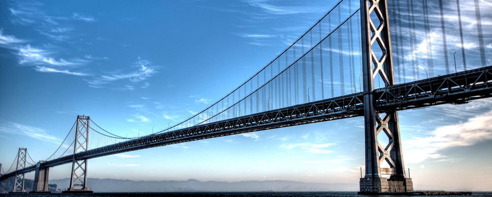
San Francisco, with the iconic Golden Gate Bridge, Alcatraz, a large Chinatown, Italian North Beach, cable cars, and numerous hills.
San Diego has a world famous zoo and separate wild animal park, the Sea World marine theme park, and a vibrant, renovated downtown core complete with major league baseball stadium
Anaheim, home to the literal ancestor of all modern theme parks, Disneyland
Santa Barbara, city on a south-facing coast which styles itself, with some justification, as "the American Riviera."
Things to do
Ski at one of the great resorts near Lake Tahoe or Big Bear.
Try your hand at surfing or work on your tanning Orange County or Santa Monica.
The long coastline offers some great California scuba diving.
Climb a mountain and camp in the Sierra Nevada or Shasta Cascades.
See California's amazing wildflowers.California Wildflower Hotline, (818) 768-3533, . From March through May, the California Wildflower Hotline at (818) 768-3533 or visit www.theodorepayne.org offers the latest information on the best places to view wildflowers throughout Southern and Central California. The hotline and website are updated every Thursday evening. More than 90 wildflower sites are included. The hotline, operating more than 25 years, is run by the Theodore Payne Foundation for Wild Flowers and Native Plants, Inc.
Northern California Blues Festival, Fastest growing festival of its kind comes in June to Sacramento County around Father's day each year and usually features a spectacular line-up of Blues artists. Event benefits Through the Mind, a non-profit providing free alternative mental health to America's Veterans.
Eat
The culinary style known as Californian Cuisine is noted for its use of fresh often local ingredients and imaginative fusion of several styles. The burrito also has its origins from California, born in the Mission District of San Francisco. Almost anything you can imagine can be found somewhere in California. Immigration has had a strong influence on California's culinary landscape, with the cuisines of The Americas and Asia heavily represented, and those of nearly every other country available to a lesser-extent. More "North American" fare includes everything from burger shacks to vegetarian, organic and even completely vegan restaurants; the Californian love for food has left it with one of the most diverse restaurant scenes in the North America. The large cities have the most variety, while things get simpler and more meat-heavy as you get more rural.
Drink
California is known for its fine wines and gourmet beers. Napa, Sonoma and Mendocino are premier wine districts north of San Francisco, but there are others in the Central Coast region and even the San Diego region where suitable microclimates have been found. The inland Central Valley region has hotter summers and traditionally produced inexpensive bulk wines, but quality has been improving with winemaking innovations.
Californians tend to view wine as a natural accompaniment of food or socializing, overlooking its alcoholic content more easily than with distilled spirits. However police crackdowns on drinking and driving are increasingly severe with roadblocks and random checks. Conviction for driving with a blood alcohol level over .08 percent is likely to bring serious legal and financial consequences. Drivers with lower blood alcohol can still be convicted for DUI (driving under the influence) if they fail field sobriety tests such as walking a straight line. You must be 21 years of age to drink any alcoholic beverage. Under age drinking is taken very seriously so if you are in a club or bar and appear to be under 30 you should be ready to present identification showing your age.
For beer, California also has a large population of microbreweries. Sierra Nevada, located in Chico, is one of the biggest microbreweries in North America. There are over 212 throughout California.
Talk
The California Constitution states that English is the official language of the state of California, but in reality, this rule is treated as a floor rather than a ceiling, and one should regard California as a multilingual state. Californian English is the main language and Spanish is the de facto second language, and a knowledge of even rudimentary Spanish is useful in most cities from the Sacramento South, which has some of the largest hispanic populations north of Mexico. The state is highly influenced by Spanish culture, as California was one part of the Spanish empire until 1821, and then to Mexico for a short while after until ceded to the USA in 1848. In fact, some of its residents declared it an independent country for about a month (The Bear Flag Republic) in the midst of the Mexican-American War 1846-1848, and many of California's cities were named after saints or phrases in Spanish (such as Los Angeles, San Diego, San Francisco, Sacramento, and San Jose). Store and street signs are sometimes written in both English and Spanish in major metropolitan areas, and "Spanglish" (a mixture of English and Spanish) is often used and heard throughout the state. Most businesses in California have at least a few employees that are bilingual in English and Spanish. Also, Chinese, Japanese, Tagalog, Korean, Vietnamese, Hindi, Punjabi, and Khmer are also widely spoken among Asian Californian populations.
Safety
Phone 911 for medical, fire, or police emergencies.
The usual inner city crime can be found in the worst parts of Los Angeles, San Francisco, and Oakland. Central Valley cities, such as Sacramento, Stockton, and Fresno also have gang problems. However, most California cities are very safe. As long as you take basic precautions against petty crime and stay out of obviously run-down neighborhoods, you will probably have a safe and pleasant visit.
Smoking is illegal in most indoor spaces, including shops, restaurants, bars, and all large workplaces. In some cities, such as Santa Monica, smoking is illegal within 20' of any doorway, and in certain outdoor public areas. Smoking may be illegal on some beaches.
Earthquakes large enough to cause damage are rare. The biggest dangers in an earthquake are falling objects and windows which shatter explosively. In the event of an earthquake, face away from windows and hide under any sturdy table or desk that may be available. If you are indoors, do not run outside! Falling building facades are more likely to cause severe injuries than anything inside. Contrary to popular belief do not stand in a door frame it is not safe at all, this is merely a myth. You're more likely to get your fingers caught in the frame from all the shaking and swinging of the door than gain protection from a falling object. If outdoors, stay away from buildings and stay out from under power lines.
Wildfires are common between May and October. Take a few precautions - throw out cigarette butts into trashcans, clear the area around campfire pits/rings in campgrounds, never leave flames unattended (even artifical ones), avoid weapon use in dry areas. The strongest impact from fires is smoke. Smoke affects areas dramatically exceeding the size of the root fire. Travellers with respiratory issues should consult visitor imformation sites before visiting areas where fires are occuring.
Arizona - Home to the Grand Canyon, Arizona borders California to the southeast across the Colorado River.
Nevada - California's eastern neighbor is best known as the home of Las Vegas, although towns such as Reno and Carson City are also good day-trip opportunities for visitors wanting to explore the Silver State.
Oregon - Sharing a border to the north, Oregon is home to impressive mountains and extensive forests.
Hawaii - Many visitors to America's fiftieth state depart through California on their journey across the Pacific.
Baja California - Those traveling across the border to Mexico can visit some of that country's most impressive sea and landscapes.
Contact & location
Be the first one to add a review
The photos displayed on this page are the property of one of the following authors:
Some photos courtesy of:
. The photos provided by Flickr are under the copyright of their owners.
This travel guide also includes text from Wikitravel articles, all available at View full credits
Neil Shaw, Ivo Louppen, Ryan Holliday, Peter Fitzgerald, Peter Southwood, Eco84, Nathan Landau, Colin Jensen, Michelle Burton, Eric Polk, Keith Malone, Nick Roux, Mike Sharp, Evan Prodromou, M. Hogue, David, Michele Ann Jenkins, Oliver Buchino, Stacy Hall, Richard Petersen, Nick Smith, Ian Kirk and Josh, Coolcaesar, LtPowers, Inas, Globe-trotter, Tatatabot, Vidimian, PerryPlanet, Morph, Tcnsc, DorganBot, Cacahuate, Kakuzatô, Jb17kx, Episteme, Jonboy, Submarine, PierreAbbat, Huttite, Dhum Dhum, Jiang and Karen Johnson
This travel guide also includes text from Wikipedia articles, all available at View full credits


California is located on the west coast of North America. It is the largest U.S. state by population, and the third largest by area. California offers something for everyone: Southern California is home to such popular attractions as Disneyland, Hollywood and the beaches in Malibu that inspired the television show Baywatch, while the northern part of California offers the iconic Golden Gate Bridge, the hills of San Francisco, the vineyards of Napa Valley, and the capital, Sacramento. Outside California's major cities one finds some of North America's most rugged national parks, incredible skiing/snowboarding opportunities, and quiet and ancient northern forests including the highest mountain peak in the contiguous USA, Mt. Whitney.
Understand
History
Human occupation in California goes back 50000 years; California was home to thirty different tribal groups prior to the arrival of European explorers in the 1500s and now over 120 tribes are left. The first Europeans were the Spanish and Portuguese, who built a settlement in California, establishing twenty-one missions in California by the late 1700s. Many of these missions survive today, including that in Santa Barbara.
After the Mexican War for Independence in 1821, California became a part of Mexico for 25 years until 1846 where it briefly became a sovereign nation, California Republic, before it was annexed by the United States in 1846. In 1848 the discovery of gold in the Sierra Nevada mountains kicked off the California Gold Rush, and California's non-native population surged from 15,000 to over 300,000 within two years.
California was recognized as a state in 1850, and its population increased steadily since then. Today California is the most populous state in the US with over 38 million residents.
Climate
The state's climate varies from temperate at the coast to the brutal winters of the mountains, to two of the world's hottest regions in the desert and the Central Valley. Rainfall is more common in the northern part of the state than in the south, and snow is rare except in the mountains.
The hottest temperature ever recorded in the Western Hemisphere, 134°F (56.6°C) was at Death Valley in 1913, and temperatures regularly exceed 120°F (49°C) during the summer. In contrast, winter temperatures in the mountains can drop below 0°F.
Landscape
With over 160,000 square miles (411,000 km2) the landscape of California is vast and varied. The state contains extremes in elevation, with Mount Whitney at 14,505 feet (4,421 meters) being the tallest mountain in the lower-48 states, while less than 200 miles away Death Valley, at 282 feet (-82 meters) below sea level, is North America's lowest point.
California's border to the west is made up of a rugged coastline along the Pacific Ocean. The coastal mountains rise up from the ocean and are home to redwood trees in the northern half. The Central Valley bisects California from north-to-south before giving way to the Sierra Nevada mountains, home of Yosemite National Park, Sequoia and Kings Canyon National Parks and other natural wonders. The southeastern part of California is dominated by desert, which covers 25% of California's total area. The Mojave is a high desert, with elevations ranging from 3,000 to 6,000 feet above sea level. This area receives less than six inches of rain each year.
People
California is a very diverse state with many ethnic groups. California has large populations of people of varied backgrounds such as Mexican, Salvadoran, Guatemalan, Armenian, Iranian, Jewish, Chinese, Russian, Filipino, Eastern Indian, Korean, Japanese, Vietnamese, Cambodian, Thai, and Hmong. California also has large populations of African Americans and Native Americans.
Californians have a wide variety of political views. The Central Valley and Orange County tend to be more conservative, while the Los Angeles Metropolitan Area (except for Orange County) and the San Francisco Bay area tend to be more liberal. The San Diego Metropolitan Area tends to be moderate.
California is a very large and populous state, with very different cultures in each region.
Regions
California varies greatly, ranging from the forested northern coastal regions to the rugged interior mountains to the harsh southern desert. Sandwiched in the center of California is the fertile Central Valley, home to a massive amount of agriculture.
Cities
These are some of the major cities in California.
Sacramento - The laid-back state capital with historic area of the city, Old Sacramento.
Los Angeles - The state's largest city, and 2nd-largest in the nation. L.A. is home to Hollywood, Venice, The Getty Center, and Griffith Park.
Bakersfield- The world's largest Basque population outside of Spain is found here and fine Basque restaurants abound.
Fresno- Gateway to Yosemite.
Palm Springs- Desert recreation with golf, spas, resorts, casinos, and the famous aerial tramway.
San Diego- Balboa Park, Old Town, SeaWorld, San Diego Zoo, and nearby Tijuana, Mexico.
San Francisco- Golden Gate Bridge, Alcatraz, Chinatown, cable cars, Victorian houses, gay & lesbian mecca.
San Jose- South of San Francisco, home of the Winchester Mystery House, and the center of Silicon Valley, which is home to many technology companies.
Santa Cruz - A central coast city. The home of the historic Santa Cruz Beach Boardwalk, Mission Santa Cruz, and the Mystery Spot.
Other destinations
Disneyland
Lake Tahoe — A large, gorgeous lake great for water sports and excellent skiing in the winter.
Napa Valley — Spas, wine tasting, wine tours.
Big Sur — one of the most scenic spots along the Pacific Coast Highway
California National Historic Trail - road to California carried over 250,000 gold-seekers & farmers to the gold fields & rich farmlands of California during the 1840's and 1850's
Juan Bautista de Anza National Historic Trail - first overland route established to connect New Spain with San Francisco
Old Spanish National Historic Trail - journey across the Southwest between Santa Fe and Los Angeles for history, culture, and scenic beauty
Pony Express National Historic Trail - used by young men on fast horses to carry the nation's mail from Missouri to California in the unprecedented time of only ten days
National Parks
Channel Islands National Park - five remarkable islands (Anacapa, Santa Cruz, Santa Rosa, San Miguel, and Santa Barbara) and their ocean environment
Death Valley National Park - A place of legend and a place of trial
Joshua Tree National Park
Lassen Volcanic National Park - witness a brief moment in the ancient battle between the earth shaping forces of creation and destruction
Redwood National Park - Stand at the base of a coast redwood and even the huckleberry bushes tower over you
Sequoia and Kings Canyon National Parks - These twin parks hold monuments to nature's size, beauty, and diversity
Yosemite National Park - one of the first wilderness parks in the United States
California State Parks
California has many state parks . A few are highlighted below:
Big Basin Redwoods State Park
Pfeiffer Big Sur State Park
Richardson Grove State Park
Calaveras Big Trees
Getting there
All major road and airport entrances (including entrances from other U.S. States) to California have agricultural inspection stations to ensure that some fruits and vegetables do not cross into a region where they may come into contact with the farms in the Central Valley. Often, travellers are subject to border inspection (somewhat strict for domestic travel) and asked if they have been on a farm or are carrying organic matter with them.
Traveling around
California is the third largest state of the U.S. in terms of size. It compares in size with Sweden. However, getting around California can be simple.
By car
In addition to interstates and US highways, California has one of the most expansive state highway systems in the United States. As with all trips in the United States, a car is usually the best way to get around and see all destinations. However the trip from the top of California to the bottom can take well over ten hours. The coast route (State Route 1 and U.S. 101) is much slower and windier than Interstate 5, and GPS travel estimate times may be inaccurate - especially on Highway 1.
Most California drivers are courteous and careful (although speeding is rampant), and the safety and ease of driving in California is comparable to most First World industrialized countries. Exceptions may be found in the most congested areas of San Francisco and Los Angeles, where road rage and reckless driving are commonplace.
California uses the MUTCD lane marking system standard throughout the United States, in which dashed white lines divide lanes of through traffic and yellow divides opposing traffic (with single dashed indicating passing and double solid indicating no passing). In many urban areas the lane markings are replaced by Botts dots for additional tactile feedback when crossing lanes.
The network of freeways in major population centers are often confusing and intimidating to those unfamiliar with the area so having a good map is very helpful. Almost all exits from freeways are on the right. At interchanges between freeways, in most cases, the flow of traffic continues through the left lanes with the transition to the other freeway being in the right lanes.
Mile-based exit numbering is currently in progress but is still very erratic in areas; an exit number may not be marked at all, may be marked on the last directional sign before the exit, or may be marked on the final "EXIT" sign itself where the exit ramp separates.
Most highways are freely accessible, although there are a handful of toll roads in Orange County, Riverside County, and San Diego. All major bridges in the San Francisco Bay Area have toll plazas on traffic in only one direction. All California toll plazas have cash lanes. Cash toll lanes are usually manned by human toll collectors, but some of the Orange County toll roads use only vending machines in the cash lanes which accept bills and coins. California toll plazas do not have "exact change" lanes where drivers may toss change in a basket. All California toll plazas also have lanes for FasTrak electronic toll collection transponders which can be used throughout the state. FasTrak is not compatible with any other state's ETC system. Going through a FasTrak-only lane without a transponder or an active FasTrak account will result in a very expensive ticket.
In major metropolitan areas, the access ramps to a freeway may have two lanes, one marked with a diamond and the other with a traffic signal. The diamond lane (called the "carpool lane") is for vehicles with two or more persons and motorcycles. Vehicles with a single person must use the lane with the traffic light. During high-traffic times, the traffic light spaces out the vehicles attempting to merge onto the freeway. Be sure to read the sign below the light as some ramps allow two or three vehicles per green. A few interchanges between freeways are now using controlled access lights to lighten the gridlock at interchanges.
Some freeways have a high occupancy vehicle (HOV) lane located along the center divider. This lane, also called the carpool lane, is marked by signage on the wall separating the two sides of the freeway, and in Southern California by a double-yellow line. In most cases, this lane is for two or more persons per vehicle. Many carpool lanes are in effect during rush hour only, and a few selected areas, notably in the Bay Area, require three or more per vehicle so check the signage before entering a carpool lane. Motorcycles may also use carpool lanes. Carpool lanes in Southern California are usually in effect 24 hours a day, and have limited access points marked by a dashed white line. This is the only point at which a vehicle may legally enter a carpool lane, since you are not allowed to cross a double yellow line. A driver may legally exit the carpool lane at any time since there is a solid white line paralleling the yellow lines. Minimum fine for unlawful use of a carpool lane is $341.
You are required to wear a seatbelt and passengers can be individually ticketed for failing to do so. Motorcycle riders must wear a helmet. Cellphone users are required to use a hands-free headset if talking on the phone while driving, and texting by the driver is illegal. Unless otherwise signed, right-turns are permitted at red lights following a full stop. If it is raining hard enough to use your windshield wipers, California law requires that your headlights be turned on.
California does not have stationary photo radar cameras like in other countries, and mobile manned photo radar units are rare and still experimental. However, most California police officers do carry radar guns and use them often, and on rural freeways, the California Highway Patrol occasionally flies aircraft overhead to spot speeders and help ground units home in on their positions. Red light enforcement cameras are in use at many urban intersections, but are usually marked only by a single "PHOTO ENFORCED" sign before the intersection. Even more confusing, all approaches to an intersection may be marked with "PHOTO ENFORCED" signs when only one or two actual movements across the intersection are really photo-enforced. The cameras must obtain a clear view of the driver's face and license plate before a ticket may be issued.
California's laws against driving under the influence of alcohol are very strict; the maximum permissible blood alcohol concentration is 0.08%. All drivers are strongly encouraged to call 911 to report drunk drivers.
By plane
Flying may be a more reasonable option from crossing large expanses of the state. Many major (like American and United) and low fare airlines (like jetBlue and Southwest) link cities within the state of California.
The primary airports are
San Francisco Bay Area--San Francisco, Oakland, San Jose
Los Angeles area--Los Angeles International (LAX), Burbank (Bob Hope), Orange County (John Wayne), Ontario (Inland Empire doesn't get a movie star), and a small airport at Long Beach
San Diego
Sacramento
Reno, Nevada for the Lake Tahoe area
Fresno The busiest second tier airports are Santa Barbara and Palm Springs.
By train
The state's various rail services provide a cheap and reasonably comfortable way to see and get around much of the state. Amtrak operates a few long-distance routes through and out of California (visit this Wikitravel article for more information), as well as the three Amtrak California routes: the San Luis Obisbo-Los Angeles-San Diego Pacific Surfliner, the Oakland/Sacramento-Bakersfield San Joaquins' (which have connecting Thruway bus service to Los Angeles)', and the San Jose-SacramentoCapitol Corridor''.
In addition, there are several commuter and regional services in the state's metro areas: Caltrain , Altamont Commuter Express and BART operate in the Bay Area, Metrolink runs throughout the Los Angeles region, and the COASTER runs along the coast of San Diego County. There are also light rail systems in San Diego, Los Angeles, San Francisco, Sacramento, and San Jose.
By bus
The bus is not the most glamorous way to get around the state, but it can be the cheapest. Greyhound serves about 100 locations statewide, though these are not all actual stations, some are merely stops. In general, Greyhound serves the same routes that Amtrak does, though in some cases the dog is cheaper, faster, or more frequent. There's fairly frequent service between San Francisco and Los Angeles, San Francisco and Sacramento, and Sacramento and Los Angeles. There's hourly "clocker" buses between Los Angeles and San Diego. The bus stations in San Francisco, Sacramento, and San Diego are all well-located, but in Los Angeles the station is over a mile east of the downtown core. On the other hand, the Santa Barbara Greyhound station is immediately behind the very upscale Saks Fifth Avenue store!
See
Some of the most famous sights in California include:
Los Angeles, home to the world-famous Hollywood sign, the Walk of Fame, the Graumann's Chinese Theater, Beverly Hills and Rodeo Drive, and miles of wide, sandy beaches.
San Francisco, with the iconic Golden Gate Bridge, Alcatraz, a large Chinatown, Italian North Beach, cable cars, and numerous hills.
San Diego has a world famous zoo and separate wild animal park, the Sea World marine theme park, and a vibrant, renovated downtown core complete with major league baseball stadium
Anaheim, home to the literal ancestor of all modern theme parks, Disneyland
Santa Barbara, city on a south-facing coast which styles itself, with some justification, as "the American Riviera."
Things to do
Ski at one of the great resorts near Lake Tahoe or Big Bear.
Try your hand at surfing or work on your tanning Orange County or Santa Monica.
The long coastline offers some great California scuba diving.
Climb a mountain and camp in the Sierra Nevada or Shasta Cascades.
See California's amazing wildflowers.California Wildflower Hotline, (818) 768-3533, . From March through May, the California Wildflower Hotline at (818) 768-3533 or visit www.theodorepayne.org offers the latest information on the best places to view wildflowers throughout Southern and Central California. The hotline and website are updated every Thursday evening. More than 90 wildflower sites are included. The hotline, operating more than 25 years, is run by the Theodore Payne Foundation for Wild Flowers and Native Plants, Inc.
Northern California Blues Festival, Fastest growing festival of its kind comes in June to Sacramento County around Father's day each year and usually features a spectacular line-up of Blues artists. Event benefits Through the Mind, a non-profit providing free alternative mental health to America's Veterans.
Eat
The culinary style known as Californian Cuisine is noted for its use of fresh often local ingredients and imaginative fusion of several styles. The burrito also has its origins from California, born in the Mission District of San Francisco. Almost anything you can imagine can be found somewhere in California. Immigration has had a strong influence on California's culinary landscape, with the cuisines of The Americas and Asia heavily represented, and those of nearly every other country available to a lesser-extent. More "North American" fare includes everything from burger shacks to vegetarian, organic and even completely vegan restaurants; the Californian love for food has left it with one of the most diverse restaurant scenes in the North America. The large cities have the most variety, while things get simpler and more meat-heavy as you get more rural.
Drink
California is known for its fine wines and gourmet beers. Napa, Sonoma and Mendocino are premier wine districts north of San Francisco, but there are others in the Central Coast region and even the San Diego region where suitable microclimates have been found. The inland Central Valley region has hotter summers and traditionally produced inexpensive bulk wines, but quality has been improving with winemaking innovations.
Californians tend to view wine as a natural accompaniment of food or socializing, overlooking its alcoholic content more easily than with distilled spirits. However police crackdowns on drinking and driving are increasingly severe with roadblocks and random checks. Conviction for driving with a blood alcohol level over .08 percent is likely to bring serious legal and financial consequences. Drivers with lower blood alcohol can still be convicted for DUI (driving under the influence) if they fail field sobriety tests such as walking a straight line. You must be 21 years of age to drink any alcoholic beverage. Under age drinking is taken very seriously so if you are in a club or bar and appear to be under 30 you should be ready to present identification showing your age.
For beer, California also has a large population of microbreweries. Sierra Nevada, located in Chico, is one of the biggest microbreweries in North America. There are over 212 throughout California.
Talk
The California Constitution states that English is the official language of the state of California, but in reality, this rule is treated as a floor rather than a ceiling, and one should regard California as a multilingual state. Californian English is the main language and Spanish is the de facto second language, and a knowledge of even rudimentary Spanish is useful in most cities from the Sacramento South, which has some of the largest hispanic populations north of Mexico. The state is highly influenced by Spanish culture, as California was one part of the Spanish empire until 1821, and then to Mexico for a short while after until ceded to the USA in 1848. In fact, some of its residents declared it an independent country for about a month (The Bear Flag Republic) in the midst of the Mexican-American War 1846-1848, and many of California's cities were named after saints or phrases in Spanish (such as Los Angeles, San Diego, San Francisco, Sacramento, and San Jose). Store and street signs are sometimes written in both English and Spanish in major metropolitan areas, and "Spanglish" (a mixture of English and Spanish) is often used and heard throughout the state. Most businesses in California have at least a few employees that are bilingual in English and Spanish. Also, Chinese, Japanese, Tagalog, Korean, Vietnamese, Hindi, Punjabi, and Khmer are also widely spoken among Asian Californian populations.
Safety
Phone 911 for medical, fire, or police emergencies.
The usual inner city crime can be found in the worst parts of Los Angeles, San Francisco, and Oakland. Central Valley cities, such as Sacramento, Stockton, and Fresno also have gang problems. However, most California cities are very safe. As long as you take basic precautions against petty crime and stay out of obviously run-down neighborhoods, you will probably have a safe and pleasant visit.
Smoking is illegal in most indoor spaces, including shops, restaurants, bars, and all large workplaces. In some cities, such as Santa Monica, smoking is illegal within 20' of any doorway, and in certain outdoor public areas. Smoking may be illegal on some beaches.
Earthquakes large enough to cause damage are rare. The biggest dangers in an earthquake are falling objects and windows which shatter explosively. In the event of an earthquake, face away from windows and hide under any sturdy table or desk that may be available. If you are indoors, do not run outside! Falling building facades are more likely to cause severe injuries than anything inside. Contrary to popular belief do not stand in a door frame it is not safe at all, this is merely a myth. You're more likely to get your fingers caught in the frame from all the shaking and swinging of the door than gain protection from a falling object. If outdoors, stay away from buildings and stay out from under power lines.
Wildfires are common between May and October. Take a few precautions - throw out cigarette butts into trashcans, clear the area around campfire pits/rings in campgrounds, never leave flames unattended (even artifical ones), avoid weapon use in dry areas. The strongest impact from fires is smoke. Smoke affects areas dramatically exceeding the size of the root fire. Travellers with respiratory issues should consult visitor imformation sites before visiting areas where fires are occuring.
Arizona - Home to the Grand Canyon, Arizona borders California to the southeast across the Colorado River.
Nevada - California's eastern neighbor is best known as the home of Las Vegas, although towns such as Reno and Carson City are also good day-trip opportunities for visitors wanting to explore the Silver State.
Oregon - Sharing a border to the north, Oregon is home to impressive mountains and extensive forests.
Hawaii - Many visitors to America's fiftieth state depart through California on their journey across the Pacific.
Baja California - Those traveling across the border to Mexico can visit some of that country's most impressive sea and landscapes.
Contact & location
Be the first one to add a review
The photos displayed on this page are the property of one of the following authors:
Maschinenraum, marya, Kai Schreiber, Daniel Catt, tylerdurden1, Dawn Endico, Paul Sapiano, Michael, telmo32
Some photos courtesy of: . The photos provided by Flickr are under the copyright of their owners.
This travel guide also includes text from Wikitravel articles, all available at View full credits
Neil Shaw, Ivo Louppen, Ryan Holliday, Peter Fitzgerald, Peter Southwood, Eco84, Nathan Landau, Colin Jensen, Michelle Burton, Eric Polk, Keith Malone, Nick Roux, Mike Sharp, Evan Prodromou, M. Hogue, David, Michele Ann Jenkins, Oliver Buchino, Stacy Hall, Richard Petersen, Nick Smith, Ian Kirk and Josh, Coolcaesar, LtPowers, Inas, Globe-trotter, Tatatabot, Vidimian, PerryPlanet, Morph, Tcnsc, DorganBot, Cacahuate, Kakuzatô, Jb17kx, Episteme, Jonboy, Submarine, PierreAbbat, Huttite, Dhum Dhum, Jiang and Karen Johnson
This travel guide also includes text from Wikipedia articles, all available at View full credits