Cham Islands Cu Lao Cham is in Hoi An Quang Nam Province of Vietnam.
Understand
Located approximately 9 nautical miles offshore and to the East of Cua Dai Beach, Hoi An, Quang Nam Province, Central Vietnam. Northern Latitude 15 deg. 52’ 30” to 16 deg. 52’ 30” N; East Longitude 108 deg. 24' 00" to 108 deg. 33' 30" E. This covers an area of 235 square kilometers (km) which include eight islands and surrounding waters. There are a total of eight islands in the "Cham Islands" called Hon Lao (largest and only island inhabited covering an area of 1,317 hectares with a hilltop elevation of 517m), Hon Cu, Hon Kho, Hon La, Hon Dai, Hon Lo and Hon Tai.
Cham islands have had their own commune and management since 1978, and were recognized as one of separated communes of Hoi An town. This admistrative island area named as the Tan Hiep Commune. Bai Lang is the capital village inhabited by about 2,400 people. Bai Huong is named for the second village of 400 people living. The commune is divided into four hamlets, three of which including Bai Lang, Cam, Bai Ong locate in Bai Lang village and the other one Bai Huong hamlet is in Bai Huong village.
History
The Cham are a Malayo-Polynesian people who originally settled in Son Huynh, Central Vietnam, around 200 B.C. The Champa Kingdom was created in Hue region around 200 A.D. and lasted until 1835.
The commercial capital of the Champa Kingdom was Hoi An from which during 7th - 10th Centuries the Champas controlled the spice trade between Spice Islands in Indonesia and China, India and Persian Gulf states. The Champas, who owned vessels very similar to those seen in Hoi An waters today, ruled the Spice Trade routes long before the Chinese junks or Portuguese vessels entered these waters.
Hoi An was a major trading port - on par with Macau and Malaka - during 16th to 18th Centuries. Early influences were Chinese and Indian and by the 10th Century some Champa had converted to Islam through Arab maritime influences.
Cham Islands due to it's leeward anchorage in the capital village of Bai Lang (from NE monsoon) makes this Bay ideal for shelter of larger vessels. Depth is approximately 15 m in the channel between Hoi An and the Cham Islands and in Bai Lang Bay averages 10 metres. Larger cargo vessels unable to enter the Hoi An river inlet would anchor off Bai Lang and smaller vessels would then carry cargo ashore to warehouses in Hoi An.
Chinese, Japanese and other Northern merchants would sail their vessels down from the North on a "broad reach" during Autumn & Winter (riding on storm blowing NE monsoon) and wait for the Trade Winds to turn during Spring and Summer into a more gentle Southerly breeze which would again send them on a "broach reach" back up North (and sometimes into seasonal Typhoons!). While they waited for winds to change some foreign merchants lived and did business in Hoi An.
It is recorded on a 700 A.D. Chinese chart that vessels sailing the "Nanhai Trade Route" used a fresh water source at Bai Lang. Nanhai means "south sea"; these ships were based in ports on the Pearl River, in Guangdong, China.
Climate
The climate is influenced by tropical monsoon and marine. If compared to the mainland, Cham islands climate is cooler. The different average temperature between the hottest and the coldest month is 6.7 deg. C. Cham islands are more humid than in the mainland. The average humidity is 85.7% and the lowest humidity is 81%. The average wind speed is higher than that in the mainland at 3.6 – 4m/s. Typhoons and heavy storms mostly appear in the islands during September and October.
The coastal areas of Quang Nam in general and Cham Islands in specific have characteristics of semi diurnal cycle, which means twice at high tide and twice at low tide in most of the days of a month. There are two periods of flood-tide and two of return-flow every month in correlation with the two periods of maximum and minimum amplitude - this is when flooding happens in Hoi An!
Dangerous floods can occur throughout Hoi An area from September - December during periods of heavy rains, strong onshore NE winds (prevailing conditions during September - December) and during 1-2 days around Lunar calendar days 1st and 14th of each month. Basically the river has no where to go as the ocean is forcing it's way inland (and average water levels are also rising each year!)
Landscape
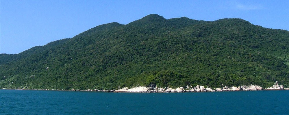
The Cham islands topography is mostly mountainous, without rivers, except for the biggest one (Hon Lao), where there are some rocky streams run down water from large natural forests. The highest point is at 517 m on the top of Hon Lao, other islands tops are lower with elevations fluctuated from 70 to 200 m.
The Cham islands geology is dominated by Pre-Cambi Macma rocks, which are almost acid and weathering. The islands largely consist of instrusive rocks. There are two distinct types of rock substance, with a clear division of these two occurring in the channel between Hon Lao and Hon Dai. Hon Lao, Hon Ong, and Hon Tai are constituted of granite and micaceous granite. These rocks are Palaeozoic – Mesozoic in age. The other islands of Hon Dai, Hon Mo, Hon La, Hon Kho, and Hon Cu are mainly granite, granodroite, and granosyenite in composition.
Flora and fauna
Hon Lao island and many of the other islands of the archipelago are extensively forested. According to the Forestry Protection Department of Quang Nam forests covered all islands are natural and extremely protected forests. Forests in Cu lao Cham play a very important role of water resources protection for the whole islands. Moreover, on the Eastern site of Hon Lao and some other rocky islands such as Hon Co, Hon Ong nest birds (for making "Bird's Nest Soup") are harvested & traded.
Marine Ecology
According to the report on marine resources survey conducted by Department of Fisheries, Department of Science, Technology, and Environment of Quang Nam Province and Nha Trang Institute of Oceanography, there are 135 species in 35 genera of corals found around Cu Lao Cham, six species in the sea of Vietnam were first recognized here. There are 202 species in 85 genera and 36 families of fish; and 4 species of lobsters and 84 species of mollusks identified.
Vietnamese Government together with Danish Government DANIDA funded the Cu Lao Cham Marine Park Administration which created Vietnam's second marine park. The expected zone for Cu Lao Cham marine protected area (MPA) included eight islands and 5,175 ha of water surface with 165 ha of coral reef, 500 ha of seaweed and sea grass beds, which provide habitat for various valuable fish species.
The water environment around the Cham Islands is an important fishery ground. Several marine products of high economic value, such as lobsters, groupers, snappers, craps, shrimps, and clams, occur in the area. The islands' coral reefs are an important area for shelter, nursery, and food providing for marine resources.
Getting there
Because of the extreme shallow water conditions at the river inlet to the ocean, which has an average depth of only 900 mm, breaking swells from September thru until December (during NE monsoon season) makes Cham Islands almost inaccessible; during January - April only sometimes accessbible; May - August almost always accessible. Weather conditions also change during the day - mornings are calmer, with stronger winds and waves after about 1pm.
Summer time squalls are frequent in late afternoons (look towards Laos and see if dark clouds are forming); beware of being caught in an unsafe boat in a dangerous squall! WORD OF WARNING!! In Vietnam few boats operate to international standards or are designed for rough waters!!
Most days at about 7.30 am when weather permits (normally NOT during September - December) a light blue coloured 20 metre long wooden, top heavy & flat bottom ferry leaves Hoi An public pier with all manner of cargo aboard bound for Cham Islands.
As a foreign tourist pay an inflated price (compared to local prices) of at least 35,000 VND one way and expect to be instructed to wear a life jacket.
Stop at Bien Phong (Border Patrol) at entrance to river inlet to ocean to show your Passport & valid visa to travel to Cham islands.
Ferry goes to largest village "Bai Lang" on largest island "Hon Lao" and returns to Hoi An departing by about 3.00 pm. Journey takes about 2 hours.
There are daily tours to Cham island operated by some departure from Cua Dai beach dock at Bien Phong ( Border Patrol ), which takes 30 minutes by speed boat and 1 hour+1/4 by wooden boat.
Traveling around
Most tourists travel on a boat with a dive operator or ferry company. Travel between two villages and beachs in between is best by bus 11 (i.e. walking on 2 legs!).
See
The sea is the biggest attraction!
Cham Islands Marine Park Administration (MPA) has a number of protected areas were only snorkelling is allowed. Snorkelling permits are required for snorkelling in these areas (income goes to MPA to support marine protection).
Forest is beautiful with wildlife including a large wild monkey population. Natural forest covers about 25% of the island.
Officially hiking is only allowed on the road between the two villages.
Cham Islands produces some of the worlds best "bird's nest soup"
Things to do
Karma Waters, 0510.3927632, 47 Cua Dai Street, Cua Dai, At Cua Dai beach bridge, *Homestay interaction tourism* inside village homes at Bai Huong village daily rates US$50/ night or beachfront US$70/ night shared room all included. Activities include sightseeing, snorkeling, Cham Island Day tour US$20/ passenger 8 am departure snorkelling, swimming, vegetarian lunch. *Traditional Vietnamese sailing* 10.5 metre ghe nang for cruises & sail training all year around Cham Islands.
Eat
Largest village Bai Lang has a few restaurants.
Smaller village Bai Huong only has one or two small coffe shops.
Sleep
Homestay Lodging
Karma Waters, 47 Cua Dai Street, Cua Dai, at Cua Dai bridge, Offers day trips and Homestay in fishing village of Bai Huong (population 500) US$50/ night shared room all included.
Safety
Because of the extreme shallow water conditions at the river inlet to the ocean, which has an average depth of only 900 mm, breaking swells from September thru until December (during NE monsoon season) makes Cham Islands almost inaccessible; during January - April only sometimes accessbible; May - August almost always accessible.
Weather conditions also change during the day - mornings are calmer, with stronger winds and waves after about 1pm.
Summer time squalls (especially later in the Summer during August) are frequent in late afternoons (look towards Laos and see if dark clouds are forming). Beware of being caught in an unsafe boat in a dangerous squall!
WORD OF WARNING!! In Vietnam few boats operate to international standards or are designed for rough waters!! locally made boats of any size are mostly flat bottomed and not seaworthy.
Fees/Permits
Generally for day trippers travelling with a dive operator a snorkelling permit is issued by the Cu Lao Cham MPA (based on payment of fee of 30,000 VND?) for each tourist coming to Cham islands. This is probably the easiest way for a Tourist to travel.
Cham Island Marine Park Administration has made it easier now for tourists to travel to Cham Islands. This has been a military island for many years.

Cham Islands Cu Lao Cham is in Hoi An Quang Nam Province of Vietnam.
Understand
Located approximately 9 nautical miles offshore and to the East of Cua Dai Beach, Hoi An, Quang Nam Province, Central Vietnam. Northern Latitude 15 deg. 52’ 30” to 16 deg. 52’ 30” N; East Longitude 108 deg. 24' 00" to 108 deg. 33' 30" E. This covers an area of 235 square kilometers (km) which include eight islands and surrounding waters. There are a total of eight islands in the "Cham Islands" called Hon Lao (largest and only island inhabited covering an area of 1,317 hectares with a hilltop elevation of 517m), Hon Cu, Hon Kho, Hon La, Hon Dai, Hon Lo and Hon Tai.
Cham islands have had their own commune and management since 1978, and were recognized as one of separated communes of Hoi An town. This admistrative island area named as the Tan Hiep Commune. Bai Lang is the capital village inhabited by about 2,400 people. Bai Huong is named for the second village of 400 people living. The commune is divided into four hamlets, three of which including Bai Lang, Cam, Bai Ong locate in Bai Lang village and the other one Bai Huong hamlet is in Bai Huong village.
History
The Cham are a Malayo-Polynesian people who originally settled in Son Huynh, Central Vietnam, around 200 B.C. The Champa Kingdom was created in Hue region around 200 A.D. and lasted until 1835.
The commercial capital of the Champa Kingdom was Hoi An from which during 7th - 10th Centuries the Champas controlled the spice trade between Spice Islands in Indonesia and China, India and Persian Gulf states. The Champas, who owned vessels very similar to those seen in Hoi An waters today, ruled the Spice Trade routes long before the Chinese junks or Portuguese vessels entered these waters.
Hoi An was a major trading port - on par with Macau and Malaka - during 16th to 18th Centuries. Early influences were Chinese and Indian and by the 10th Century some Champa had converted to Islam through Arab maritime influences.
Cham Islands due to it's leeward anchorage in the capital village of Bai Lang (from NE monsoon) makes this Bay ideal for shelter of larger vessels. Depth is approximately 15 m in the channel between Hoi An and the Cham Islands and in Bai Lang Bay averages 10 metres. Larger cargo vessels unable to enter the Hoi An river inlet would anchor off Bai Lang and smaller vessels would then carry cargo ashore to warehouses in Hoi An.
Chinese, Japanese and other Northern merchants would sail their vessels down from the North on a "broad reach" during Autumn & Winter (riding on storm blowing NE monsoon) and wait for the Trade Winds to turn during Spring and Summer into a more gentle Southerly breeze which would again send them on a "broach reach" back up North (and sometimes into seasonal Typhoons!). While they waited for winds to change some foreign merchants lived and did business in Hoi An.
It is recorded on a 700 A.D. Chinese chart that vessels sailing the "Nanhai Trade Route" used a fresh water source at Bai Lang. Nanhai means "south sea"; these ships were based in ports on the Pearl River, in Guangdong, China.
Climate
The climate is influenced by tropical monsoon and marine. If compared to the mainland, Cham islands climate is cooler. The different average temperature between the hottest and the coldest month is 6.7 deg. C. Cham islands are more humid than in the mainland. The average humidity is 85.7% and the lowest humidity is 81%. The average wind speed is higher than that in the mainland at 3.6 – 4m/s. Typhoons and heavy storms mostly appear in the islands during September and October.
The coastal areas of Quang Nam in general and Cham Islands in specific have characteristics of semi diurnal cycle, which means twice at high tide and twice at low tide in most of the days of a month. There are two periods of flood-tide and two of return-flow every month in correlation with the two periods of maximum and minimum amplitude - this is when flooding happens in Hoi An!
Dangerous floods can occur throughout Hoi An area from September - December during periods of heavy rains, strong onshore NE winds (prevailing conditions during September - December) and during 1-2 days around Lunar calendar days 1st and 14th of each month. Basically the river has no where to go as the ocean is forcing it's way inland (and average water levels are also rising each year!)
Landscape
The Cham islands topography is mostly mountainous, without rivers, except for the biggest one (Hon Lao), where there are some rocky streams run down water from large natural forests. The highest point is at 517 m on the top of Hon Lao, other islands tops are lower with elevations fluctuated from 70 to 200 m.
The Cham islands geology is dominated by Pre-Cambi Macma rocks, which are almost acid and weathering. The islands largely consist of instrusive rocks. There are two distinct types of rock substance, with a clear division of these two occurring in the channel between Hon Lao and Hon Dai. Hon Lao, Hon Ong, and Hon Tai are constituted of granite and micaceous granite. These rocks are Palaeozoic – Mesozoic in age. The other islands of Hon Dai, Hon Mo, Hon La, Hon Kho, and Hon Cu are mainly granite, granodroite, and granosyenite in composition.
Flora and fauna
Hon Lao island and many of the other islands of the archipelago are extensively forested. According to the Forestry Protection Department of Quang Nam forests covered all islands are natural and extremely protected forests. Forests in Cu lao Cham play a very important role of water resources protection for the whole islands. Moreover, on the Eastern site of Hon Lao and some other rocky islands such as Hon Co, Hon Ong nest birds (for making "Bird's Nest Soup") are harvested & traded.
Marine Ecology
According to the report on marine resources survey conducted by Department of Fisheries, Department of Science, Technology, and Environment of Quang Nam Province and Nha Trang Institute of Oceanography, there are 135 species in 35 genera of corals found around Cu Lao Cham, six species in the sea of Vietnam were first recognized here. There are 202 species in 85 genera and 36 families of fish; and 4 species of lobsters and 84 species of mollusks identified.
Vietnamese Government together with Danish Government DANIDA funded the Cu Lao Cham Marine Park Administration which created Vietnam's second marine park. The expected zone for Cu Lao Cham marine protected area (MPA) included eight islands and 5,175 ha of water surface with 165 ha of coral reef, 500 ha of seaweed and sea grass beds, which provide habitat for various valuable fish species.
The water environment around the Cham Islands is an important fishery ground. Several marine products of high economic value, such as lobsters, groupers, snappers, craps, shrimps, and clams, occur in the area. The islands' coral reefs are an important area for shelter, nursery, and food providing for marine resources.
Getting there
Because of the extreme shallow water conditions at the river inlet to the ocean, which has an average depth of only 900 mm, breaking swells from September thru until December (during NE monsoon season) makes Cham Islands almost inaccessible; during January - April only sometimes accessbible; May - August almost always accessible. Weather conditions also change during the day - mornings are calmer, with stronger winds and waves after about 1pm.
Summer time squalls are frequent in late afternoons (look towards Laos and see if dark clouds are forming); beware of being caught in an unsafe boat in a dangerous squall! WORD OF WARNING!! In Vietnam few boats operate to international standards or are designed for rough waters!!
Most days at about 7.30 am when weather permits (normally NOT during September - December) a light blue coloured 20 metre long wooden, top heavy & flat bottom ferry leaves Hoi An public pier with all manner of cargo aboard bound for Cham Islands.
As a foreign tourist pay an inflated price (compared to local prices) of at least 35,000 VND one way and expect to be instructed to wear a life jacket.
Stop at Bien Phong (Border Patrol) at entrance to river inlet to ocean to show your Passport & valid visa to travel to Cham islands.
Ferry goes to largest village "Bai Lang" on largest island "Hon Lao" and returns to Hoi An departing by about 3.00 pm. Journey takes about 2 hours.
There are daily tours to Cham island operated by some departure from Cua Dai beach dock at Bien Phong ( Border Patrol ), which takes 30 minutes by speed boat and 1 hour+1/4 by wooden boat.
Traveling around
Most tourists travel on a boat with a dive operator or ferry company. Travel between two villages and beachs in between is best by bus 11 (i.e. walking on 2 legs!).
See
The sea is the biggest attraction!
Cham Islands Marine Park Administration (MPA) has a number of protected areas were only snorkelling is allowed. Snorkelling permits are required for snorkelling in these areas (income goes to MPA to support marine protection).
Forest is beautiful with wildlife including a large wild monkey population. Natural forest covers about 25% of the island.
Officially hiking is only allowed on the road between the two villages.
Cham Islands produces some of the worlds best "bird's nest soup"
Things to do
Eat
Largest village Bai Lang has a few restaurants.
Smaller village Bai Huong only has one or two small coffe shops.
Sleep
Homestay Lodging
Safety
Because of the extreme shallow water conditions at the river inlet to the ocean, which has an average depth of only 900 mm, breaking swells from September thru until December (during NE monsoon season) makes Cham Islands almost inaccessible; during January - April only sometimes accessbible; May - August almost always accessible.
Weather conditions also change during the day - mornings are calmer, with stronger winds and waves after about 1pm.
Summer time squalls (especially later in the Summer during August) are frequent in late afternoons (look towards Laos and see if dark clouds are forming). Beware of being caught in an unsafe boat in a dangerous squall!
WORD OF WARNING!! In Vietnam few boats operate to international standards or are designed for rough waters!! locally made boats of any size are mostly flat bottomed and not seaworthy.
Fees/Permits
Generally for day trippers travelling with a dive operator a snorkelling permit is issued by the Cu Lao Cham MPA (based on payment of fee of 30,000 VND?) for each tourist coming to Cham islands. This is probably the easiest way for a Tourist to travel.
Cham Island Marine Park Administration has made it easier now for tourists to travel to Cham Islands. This has been a military island for many years.
Get out
Contact & location
Be the first one to add a review
The photos displayed on this page are the property of one of the following authors:
Kok Leng Yeo, Lê Thanh V?nh, walehiane, tamngu
Some photos courtesy of: ,
,  . The photos provided by Flickr, Panoramio are under the copyright of their owners.
This travel guide also includes text from Wikitravel articles, all available at View full credits
Gnomee, Paul Tarrant, Pashley
This travel guide also includes text from Wikipedia articles, all available at View full credits