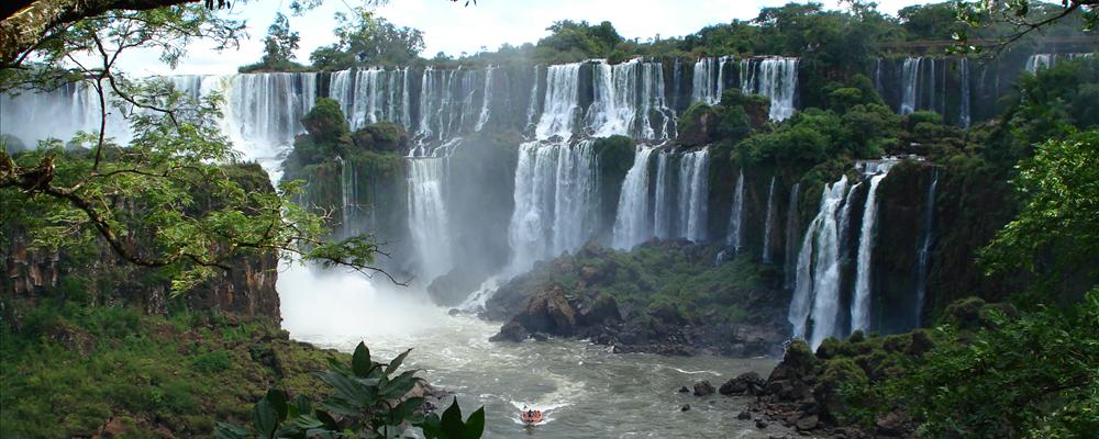
Iguazu Falls are the result of a volcanic eruption which left a large crack in the earth. During the rainy season of November - March, the rate flow of water going over the falls may reach 450,000 cubic feet (12,750 cubic m) per second. Iguazu Falls are divided by various islands into separate waterfalls. In guarani language, the term "Iguazú" means "great waters". The Falls were discovered in 1541 by Alvar Núñez Cabeza de Vaca and since 1984 it is part of UNESCO Natural World Heritage Site.
Of the 275 falls that collectively make up Iguassu Falls, "Devil's Throat" is the tallest at 80 meters high. Iguazu Falls are on the border between the Brazilian state of Paraná and the Argentine province of Misiones, and are surrounded by two National Parks (one in Brazil, and one in Argentina). Both are subtropical rainforests that are host to hundreds of rare and endangered species of flora and fauna.
Contact & location
Be the first one to add a review
The photos displayed on this page are the property of one of the following authors:


General
Iguazu Falls are the result of a volcanic eruption which left a large crack in the earth. During the rainy season of November - March, the rate flow of water going over the falls may reach 450,000 cubic feet (12,750 cubic m) per second. Iguazu Falls are divided by various islands into separate waterfalls. In guarani language, the term "Iguazú" means "great waters". The Falls were discovered in 1541 by Alvar Núñez Cabeza de Vaca and since 1984 it is part of UNESCO Natural World Heritage Site.
Of the 275 falls that collectively make up Iguassu Falls, "Devil's Throat" is the tallest at 80 meters high. Iguazu Falls are on the border between the Brazilian state of Paraná and the Argentine province of Misiones, and are surrounded by two National Parks (one in Brazil, and one in Argentina). Both are subtropical rainforests that are host to hundreds of rare and endangered species of flora and fauna.
Contact & location
Be the first one to add a review
The photos displayed on this page are the property of one of the following authors:
Ricardo Martins, Jimmy Harris, Phil Whitehouse, João Paulo Corrêa de Carvalho
Some photos courtesy of: . The photos provided by Flickr are under the copyright of their owners.
This travel guide also includes text from Wikitravel articles, all available at View full credits
This travel guide also includes text from Wikipedia articles, all available at View full credits