The Federated States of Micronesia is a country in the northwestern Pacific Ocean. It is composed of four major island groups totaling 607 islands that lie just north of the equator about three-quarters of the way from Hawaii to Indonesia, to the north of Papua New Guinea and the Solomon Islands and to the south of the Marshall Islands, the Northern Mariana Islands and Guam.
Understand
Climate
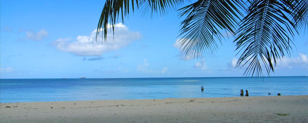
Tropical; heavy year-round rainfall, especially in the eastern islands; located on southern edge of the typhoon belt with occasionally severe damage; Natural hazards : typhoons (June to December).
Terrain
Islands vary geologically from high mountainous islands to low, coral atolls; volcanic outcroppings on Pohnpei, Kosrae, and Truk
Highest point
Dolohmwar (Totolom) 791 m
History
National holiday
Constitution Day, 10 May (1979)
Constitution
10 May 1979
In 1979 the Federated States of Micronesia, a UN Trust Territory under US administration, adopted a constitution. On 3 November 1986 independence was attained under a Compact of Free Association with the US; economic provisions of the Compact are being renegotiated.
Independence
3 November 1986 (from the US-administered UN Trusteeship)
Present concerns include large-scale unemployment, overfishing, and overdependence on US aid.
Climate
Tropical; heavy year-round rainfall, especially in the eastern islands; located on southern edge of the typhoon belt with occasionally severe damage; Natural hazards : typhoons (June to December).
The remote atoll of Kapingamarangi is the southernmost island group in FSM.
Getting there
By plane
The major airline that travels to FSM is Continental Airlines, which operates a thrice-weekly "island hopper" flight (CO956 eastbound, CO957 westbound) traveling Honolulu—Majuro—Kwajalein—Kosrae—Pohnpei—Chuuk—Guam and vice versa. The flight is fourteen and a half hours, leaving in the early morning and terminating in the evening, with a stop of about one hour on each island. There are also nonstop flights from various islands to both Honolulu and Guam.
Honolulu is the most direct gateway into the islands from North America. Guam is the most direct gateway from most points in Asia and Australia, although it is also possible to fly into the islands from Manila via Palau.
By boat
The major international ports are; Chuuk,Pohnpei and Yap. There are inter-island trading ships based in these major ports which visits the outlying islands.
Traveling around
By bus
Even though there are no bus scheduled service on the island, some buses are available to hire or charter. Also, on Yap there is a school bus that runs twice daily from Colonia to the villages.
Taxi
Taxi service is available throughout the islands and are inexpensive.
Car Hire
There are self-driven cars available in the major towns of the islands. However, It is required to have a National Driver's License or International Driving Permit.
Sleep
Kosrae Nautilus Resort, + 691 370 3567, P.O. Box 135, Kosrae, Micronesia, 15 minute drive from the airport on the eastern side of the island, adjacent to the ocean, 18-room modern hotel with air-conditioned rooms and restaurant, or outside dining by the swimming pool. Free airport transfers, full service scuba dive operation including NAUI scuba instruction. Tour and rental cars arranged. Located adjacent to the Lelu causeway facing east to the Pacific Ocean, with 3 acres of manicured gardens.
Talk
Languages
English (official and common language), Trukese, Pohnpeian, Yapese, Kosrean, Ulithian, Woleaian, Nukuoro, Kapingamarangi
Safety
FSM is one of the safest places on earth. there is little violent crime.
beware, it is also one of the wettest places on earth, and rains almost everyday.
Contact & location
Be the first one to add a review
The photos displayed on this page are the property of one of the following authors:
Some photos courtesy of:
. The photos provided by Flickr are under the copyright of their owners.
This travel guide also includes text from Wikitravel articles, all available at View full credits
ChubbyWimbusR. Quinn, Colin Jensen, marc gordon, Stephen Atkins, Ryan Holliday, Ravikiran Rao, Evan Prodromou, Daniel Cowan and Yann Forget, Roundtheworld, Tatatabot, Inas, Ypsilon, Hot Coffee, Arjuna808, Episteme, InterLangBot, Hansm, Nils, Huttite, Akubra and CIAWorldFactbook2002
This travel guide also includes text from Wikipedia articles, all available at View full credits


The Federated States of Micronesia is a country in the northwestern Pacific Ocean. It is composed of four major island groups totaling 607 islands that lie just north of the equator about three-quarters of the way from Hawaii to Indonesia, to the north of Papua New Guinea and the Solomon Islands and to the south of the Marshall Islands, the Northern Mariana Islands and Guam.
Understand
Climate
Tropical; heavy year-round rainfall, especially in the eastern islands; located on southern edge of the typhoon belt with occasionally severe damage; Natural hazards : typhoons (June to December).
Terrain
Islands vary geologically from high mountainous islands to low, coral atolls; volcanic outcroppings on Pohnpei, Kosrae, and Truk
History
In 1979 the Federated States of Micronesia, a UN Trust Territory under US administration, adopted a constitution. On 3 November 1986 independence was attained under a Compact of Free Association with the US; economic provisions of the Compact are being renegotiated.
Present concerns include large-scale unemployment, overfishing, and overdependence on US aid.
Climate
Tropical; heavy year-round rainfall, especially in the eastern islands; located on southern edge of the typhoon belt with occasionally severe damage; Natural hazards : typhoons (June to December).
Regions
There are 4 states:
Chuuk (Truk)
Kosrae (Kosaie)
Pohnpei (Ponape)
Yap
Cities
Ports and harbors
Colonia - (Yap)
Kolonia - (Pohnpei)
Lele
Moen
Other destinations
The remote atoll of Kapingamarangi is the southernmost island group in FSM.
Getting there
By plane
The major airline that travels to FSM is Continental Airlines, which operates a thrice-weekly "island hopper" flight (CO956 eastbound, CO957 westbound) traveling Honolulu—Majuro—Kwajalein—Kosrae—Pohnpei—Chuuk—Guam and vice versa. The flight is fourteen and a half hours, leaving in the early morning and terminating in the evening, with a stop of about one hour on each island. There are also nonstop flights from various islands to both Honolulu and Guam.
Honolulu is the most direct gateway into the islands from North America. Guam is the most direct gateway from most points in Asia and Australia, although it is also possible to fly into the islands from Manila via Palau.
By boat
The major international ports are; Chuuk,Pohnpei and Yap. There are inter-island trading ships based in these major ports which visits the outlying islands.
Traveling around
By bus
Even though there are no bus scheduled service on the island, some buses are available to hire or charter. Also, on Yap there is a school bus that runs twice daily from Colonia to the villages.
Taxi
Taxi service is available throughout the islands and are inexpensive.
Car Hire
There are self-driven cars available in the major towns of the islands. However, It is required to have a National Driver's License or International Driving Permit.
Sleep
Talk
Safety
FSM is one of the safest places on earth. there is little violent crime. beware, it is also one of the wettest places on earth, and rains almost everyday.
Contact & location
Be the first one to add a review
The photos displayed on this page are the property of one of the following authors:
tata_aka_T, ptrktn, Cliff, ctsnow
Some photos courtesy of: . The photos provided by Flickr are under the copyright of their owners.
This travel guide also includes text from Wikitravel articles, all available at View full credits
ChubbyWimbusR. Quinn, Colin Jensen, marc gordon, Stephen Atkins, Ryan Holliday, Ravikiran Rao, Evan Prodromou, Daniel Cowan and Yann Forget, Roundtheworld, Tatatabot, Inas, Ypsilon, Hot Coffee, Arjuna808, Episteme, InterLangBot, Hansm, Nils, Huttite, Akubra and CIAWorldFactbook2002
This travel guide also includes text from Wikipedia articles, all available at View full credits