Tasik Kenyir is in Terengganu, on the East Coast of Peninsular Malaysia.
Understand
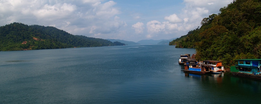
Tasik Kenyir is a reservoir lake formed from the damming of the Kenyir River in Ulu (upriver) Terengganu. The lake is very large and contains some islands. Because of its inland location and moderate elevation above sea level, its climate is somewhat cooler and moister than on the seacoast. There is a breathtaking view from the top of the dam itself, and many visitors hire a boat to see the rest. There are also caves and a small waterfall nearby.
Getting there
The best way to access the lake is by car. Make sure you have a map, and if you're travelling from the coast, be prepared for a somewhat lengthy drive on small local roads through kampung (villages) when you get past the Kuala Berang area.
See
Waterfalls, caves, forest.
Things to do
Fishing, camping and trekking, visit waterfalls, go to caves, water sports.
Fees/Permits
Available at Gawai Jetty HQ. Entry fee RM1, camera RM5, fishing RM10, camping RM1
If you are going into Taman Negara National Park you need an additional permit from the Wildlife Office at Kuala Berang or the National Park entry point at Tanjung Mentong.
Contact & location
Be the first one to add a review
The photos displayed on this page are the property of one of the following authors:

Tasik Kenyir is in Terengganu, on the East Coast of Peninsular Malaysia.
Understand
Tasik Kenyir is a reservoir lake formed from the damming of the Kenyir River in Ulu (upriver) Terengganu. The lake is very large and contains some islands. Because of its inland location and moderate elevation above sea level, its climate is somewhat cooler and moister than on the seacoast. There is a breathtaking view from the top of the dam itself, and many visitors hire a boat to see the rest. There are also caves and a small waterfall nearby.
Getting there
The best way to access the lake is by car. Make sure you have a map, and if you're travelling from the coast, be prepared for a somewhat lengthy drive on small local roads through kampung (villages) when you get past the Kuala Berang area.
See
Waterfalls, caves, forest.
Things to do
Fishing, camping and trekking, visit waterfalls, go to caves, water sports.
Fees/Permits
Available at Gawai Jetty HQ. Entry fee RM1, camera RM5, fishing RM10, camping RM1 If you are going into Taman Negara National Park you need an additional permit from the Wildlife Office at Kuala Berang or the National Park entry point at Tanjung Mentong.
Contact & location
Be the first one to add a review
The photos displayed on this page are the property of one of the following authors:
Mohd Fahmi Mohd Azmi
Some photos courtesy of: . The photos provided by Flickr are under the copyright of their owners.
This travel guide also includes text from Wikitravel articles, all available at View full credits
LizAnonymous user(s) of Wikitravel.
This travel guide also includes text from Wikipedia articles, all available at View full credits